
Weather 101 / History
The Blizzard of 1888 in New Jersey, NYC and Philadelphia: Snow, Wind and Deadly Cold
Few storms in Northeast weather history are as famous as the Blizzard of 1888. It arrived in mid-March, when people were thinking about spring, and it still shows up in our record books more than 130 years later. Here's what the official records tell us about how it played out in New Jersey, New York City and Philadelphia.
It started as rain
The storm began on Sunday, March 11, 1888, and for most of our area it didn't look like a blizzard at first. Temperatures that day were in the 40s, and the weather observers of the time wrote down rain, not snow. Some of the rain totals were heavy:
- Vineland (Cumberland County): 3.69 inches of rain on March 11.
- Trenton: 2.22 inches.
- Moorestown (Burlington County): 1.86 inches.
- Philadelphia: 1.25 inches.
- Central Park, New York City: 0.65 inch.
Then cold air poured in, and the rain changed to snow. If you've followed a rain-snow line forecast, you know how much that changeover matters.
How much snow fell
Monday, March 12 was the big day. Here's what the records show, from north to south:
- Central Park, New York City: 21.0 inches from March 12 to 14. It still ranks as the fourth-biggest snowstorm in Central Park records going back to 1869.
- New Brunswick (Middlesex County): the New Jersey State Climatologist at Rutgers lists the 1888 blizzard as the top snowstorm on New Brunswick's record, with an estimated 3 feet.
- Trenton: 21.0 inches on March 12, from 2.70 inches of melted precipitation.
- Quakertown (Bucks County, PA): 12.0 inches.
- Philadelphia: 10.5 inches on March 12. The National Weather Service notes that it is still Philadelphia's snowfall record for that date.
- Atlantic City: 7.0 inches.
- Vineland: 5.0 inches, on top of its soaking rain the day before.
The National Weather Service office in Mount Holly says snowfall averaged 40 inches or more over New Jersey, southeastern New York and southern New England. The official measurements in our biggest cities were lower than that, so local totals varied a lot. Trenton's numbers also tell us something about the snow itself. About 21 inches from 2.7 inches of water is roughly 8 inches of snow for every inch of water, a heavy, wet snow. (Our guide to snow ratios explains why that matters.)
Wind and drifts
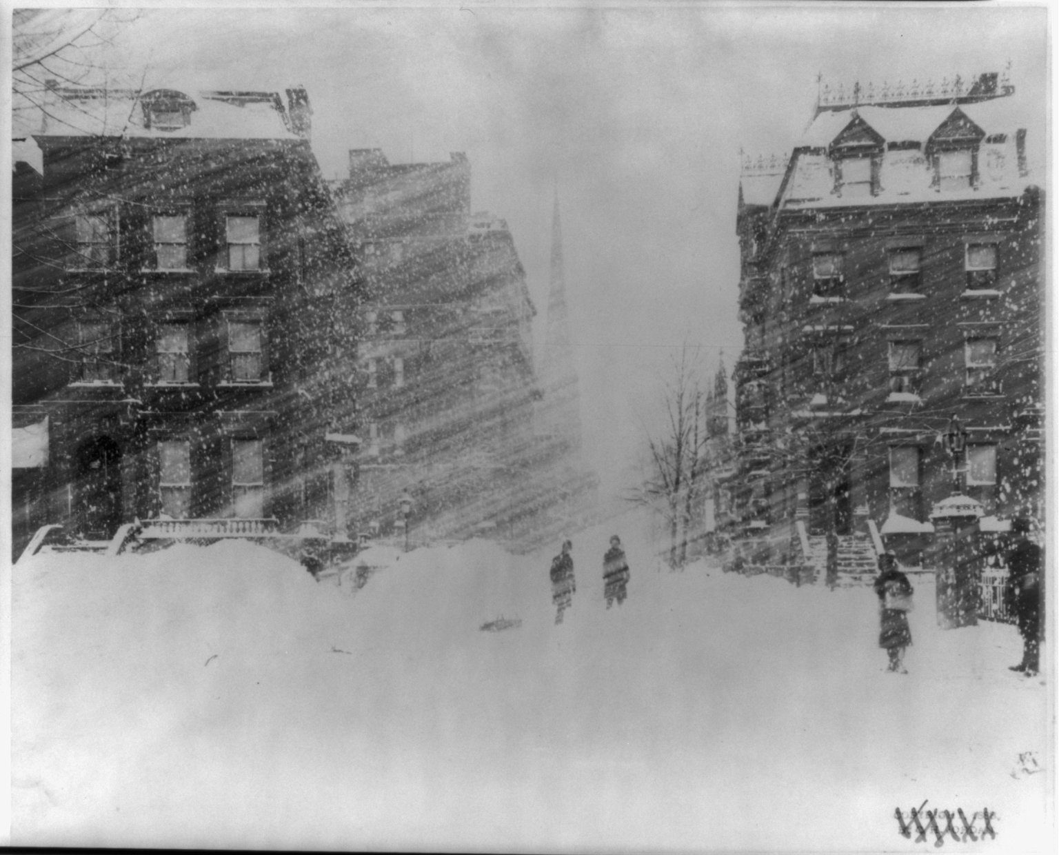
Snow alone doesn't make a blizzard. Wind does. The National Weather Service's historical summary says the wind averaged 20 to 25 mph across the region for four days, at times reaching 50 to over 70 mph. In Philadelphia, a sustained northwest wind of 60 mph was recorded, still the strongest wind measurement for any March at the city's weather station. The National Weather Service office for Baltimore and Washington says New York's wind roared at 35 mph with gusts up to 75 mph, blowing drifts as deep as 20 feet and burying some homes and buildings.
The cold behind the storm
The storm didn't end when the snow stopped. Temperatures crashed from the 40s on Sunday into the single digits by Tuesday morning, March 13:
- Salem (Salem County): a low of 1 degree.
- Quakertown: 2 degrees.
- Central Park and Trenton: 6 degrees.
- Philadelphia: 8 degrees.
- Atlantic City: 11 degrees.
On March 13, 1888, Newark's high was only 18 degrees and the low was 4. According to the State Climatologist's daily records for Newark, which go back to the 1840s, both are still the coldest high and the coldest low on record there for that date. Central Park's high that day was just 12 degrees. In fact, 1888 is still the coldest year on record at Central Park.
The human toll
The National Weather Service's historical summary for our region lists Washington, Philadelphia, New York and Boston among the cities paralyzed by the storm. In New York City alone, it counts 200 deaths, uncounted injuries and damage near $20 million in the money of the time. Total deaths from the blizzard were over 400.
The storm also cut cities off from each other. In Washington, falling trees and ice brought down telegraph poles and electric lines, and the National Weather Service says it took a week to restore the links and for Washington to learn that Baltimore and New York had been hit even harder.
Why the numbers are a little uneven
You may notice we give exact totals for some towns and an estimate for others. Weather records in 1888 were kept by a small number of official stations and volunteer observers, who wrote their readings down by hand. Some stations missed days during the storm, and some towns had no observer at all. The State Climatologist's statewide snowfall estimates only go back to 1895, so 1888 isn't part of that series.
How it changed New York
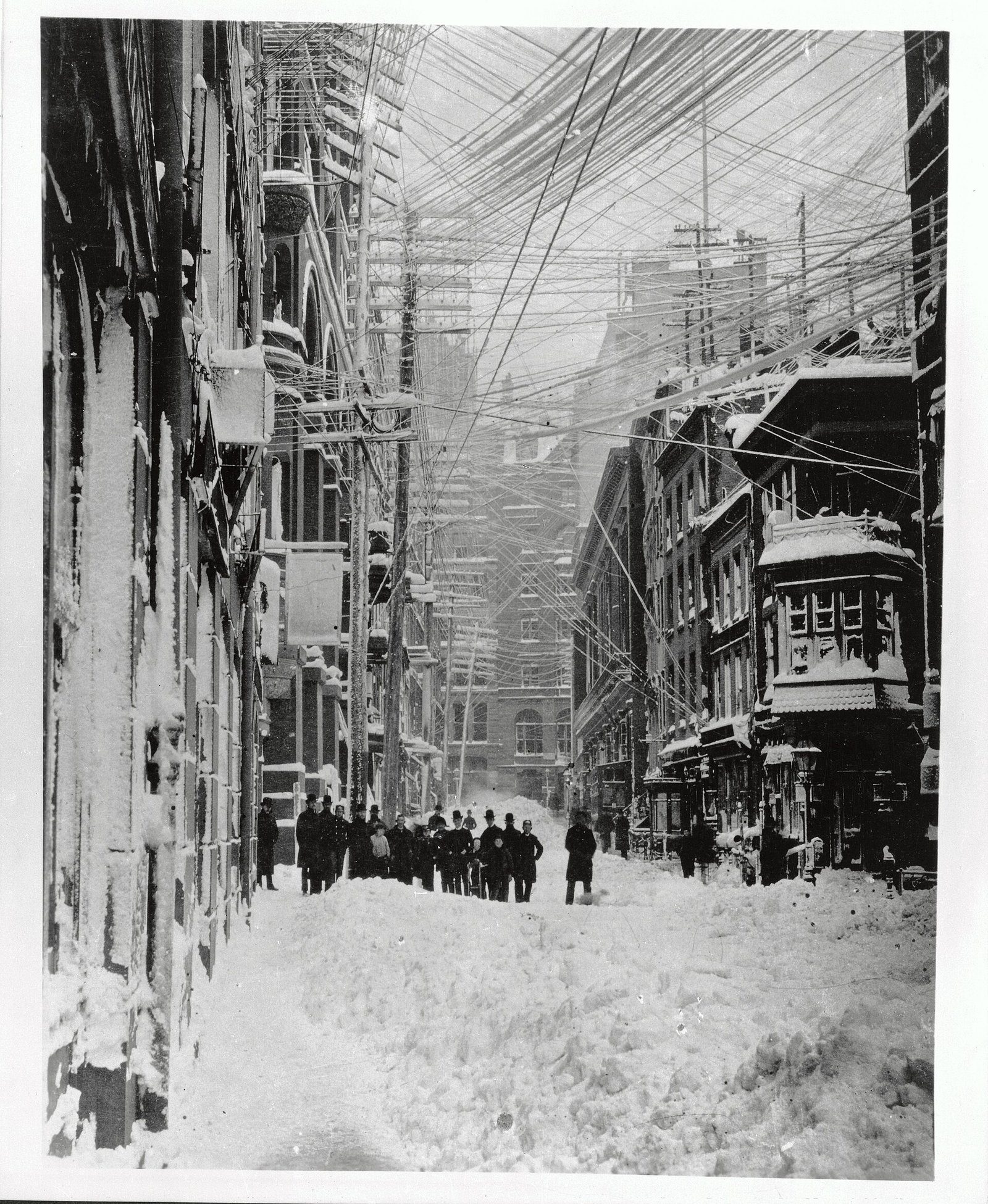
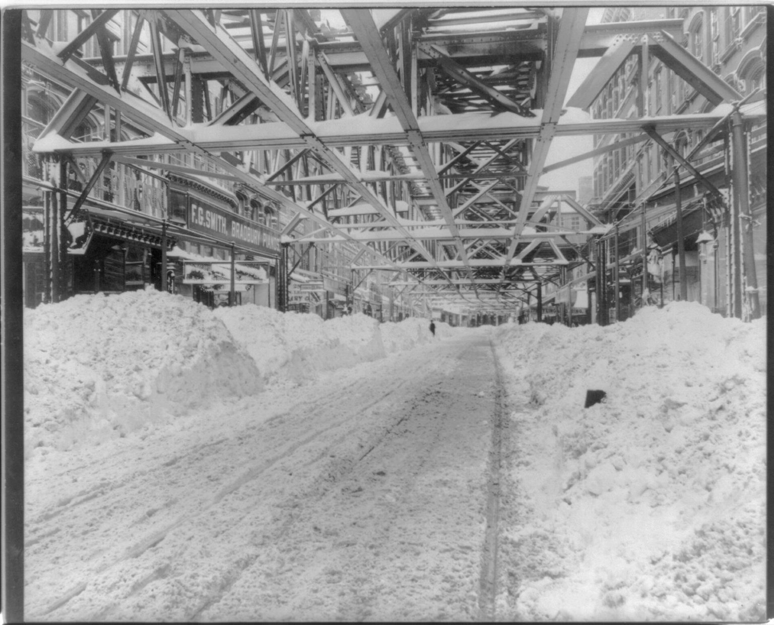
The blizzard did more than break snow records. It showed how fragile the city's above-ground systems were. On March 12, every horsecar and elevated train in New York stopped running, and nearly all the telegraph and telephone wires came down. The next morning's New York Times argued that two things now had to happen: a rapid transit system that storms couldn't shut down, and putting all the city's electric wires underground "without any delay."
- Wires went underground. Before 1888, telephone, telegraph and electric lines were strung on poles above the streets. According to the Museum of the City of New York, the massive snows of the 1888 blizzard led the city to move those cables underground, reached through a network of manholes. That's a big reason Manhattan's power and phone lines rarely fail in storms today.
- The push for a subway. The standstill on the elevated lines helped convince the city to plan an underground railroad. That plan took shape in 1894, construction began in 1900, and New York's first subway line opened in 1904.
A storm that hit New Jersey and New York in 1888 is part of why the region's transit and power systems look the way they do now.
Forecasting then and now
In 1888, the national weather service was part of the U.S. Army Signal Service, which had run it since 1870. It became a civilian agency, the U.S. Weather Bureau in the Department of Agriculture, on October 1, 1890. Forecasters had no radar, no weather satellites and no computer models. They worked from a limited number of telegraphed observations and hand-drawn weather maps, so a fast-changing storm could arrive with little warning.
Today, satellites watch storms form days before they reach us, radar tracks every band of snow, and computer models (whose story begins in Princeton, as we explain in our article on the Thanksgiving Storm of 1950) show the cold air, the rain-snow line and the likely snow totals ahead of time. The hard part now is the details, which is why snow forecasts change as a storm gets closer.
Could it happen again?
Yes. The ingredients of 1888 were a strong coastal storm, plenty of moisture, strong wind and a fresh push of very cold air, and that combination still happens. The Blizzard of 1996 and the Blizzard of 2016 are recent reminders that our area can still get a crippling snowstorm. What's changed is warning time. If a storm like this were on the way:
- Watch the changeover: a storm that starts as rain can still bury you once the cold air arrives. Plan for the snow, not the first few hours.
- Plan for the cold after: the coldest air often comes right behind a big snowstorm. Make sure your heat, power and medications are covered.
- Stay off the roads when warnings say to: blowing snow and whiteouts make travel dangerous, and the safest place is home.
We'll always post our snow maps and updates here at New Jersey Weather Center when a big storm is coming.
- nycsubway.org (G. J. Christiano): The Blizzard of 1888; the Impact of this Devastating Storm on New York Transit, with New York Times excerpts from March 13, 1888
- Museum of the City of New York, The Greatest Grid: The Underground Grid
- National Weather Service Philadelphia/Mount Holly: Historical Weather for Philadelphia/Mt. Holly, NJ WFO (March 11-14, 1888 entries)
- National Weather Service Baltimore/Washington: DC Winters (March 11-13, 1888)
- National Weather Service New York: Biggest Snowstorms (One Foot or More) at Central Park, and All-Time Extremes, Central Park
- Office of the New Jersey State Climatologist (Rutgers): winter 2005-06 summary (New Brunswick's top storm) and Daily Normals and Extremes (Newark)
- National Weather Service: History of the National Weather Service (timeline)
- Iowa Environmental Mesonet (Iowa State University): NWS Cooperative Observer daily data (Trenton, Philadelphia, Quakertown, Atlantic City, Vineland, Salem, Moorestown, Central Park, March 1888)
For dangerous weather, always follow official National Weather Service warnings and your local emergency officials.