
Weather 101 / History
The Blizzard of January 2016: Central Park's Record 27.5 Inches and 30 in North Jersey
The blizzard of January 22 to 24, 2016 is one of the biggest snowstorms our area has ever seen. It buried central and northern New Jersey under 2 to 2.5 feet of snow, gave Central Park its biggest snowstorm since records began in 1869, dropped more than 30 inches at JFK Airport and in Allentown, and sent the ocean into Cape May County at levels higher than during Sandy. Here is what happened, with the numbers from the National Weather Service and the New Jersey State Climatologist.
How the storm came together
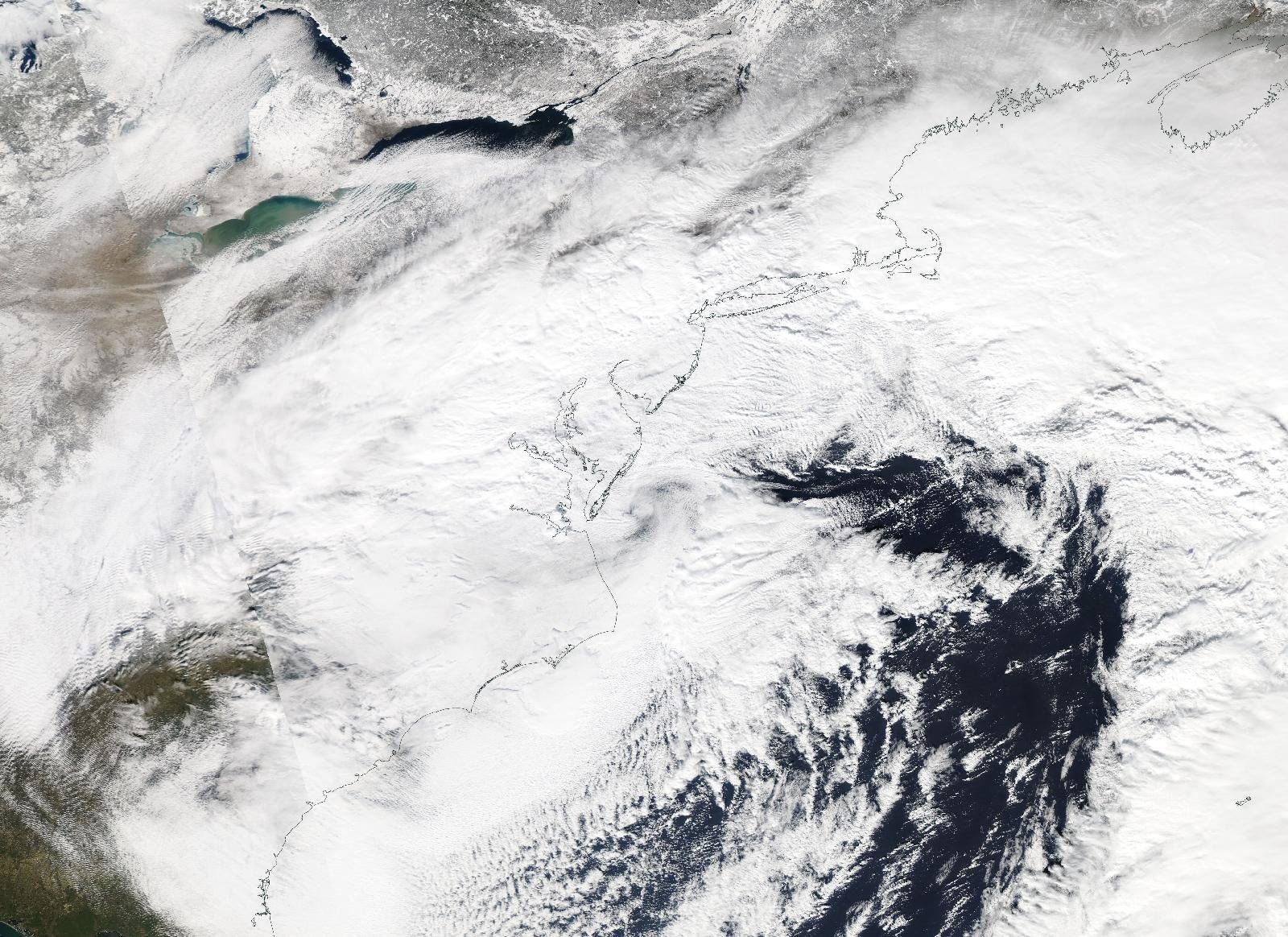
This was a classic nor'easter. A strong low pressure system moved up to a spot off the Virginia coast, then turned east and out to sea. On its north side, cold air and a steady feed of Atlantic moisture produced heavy snow, while the pressure difference between the storm and high pressure to the north drove strong winds.
Snow began in South Jersey early in the evening of Friday, January 22, and spread north overnight. By Saturday morning it was snowing heavily almost everywhere, at times more than 2 inches an hour, with the wind howling. Along parts of the central and southern coast the snow turned to a mix of sleet and rain for a while before going back to snow. The snow tapered off around midnight Saturday night.
How much snow fell
The heaviest snow fell in central and northern New Jersey, especially between the I-78 and I-80 corridors. The State Climatologist's evaluated totals include:
- Highest in New Jersey: 30.0 inches at Long Valley and Succasunna in Morris County and in Bernards Township in Somerset County.
- Other county highs: Hunterdon 29.6 inches, Union 28.3, Middlesex 28.1, Warren 28.0, Hudson 26.5, Monmouth 25.5, Mercer 24.0 and Bergen 23.9.
- Newark Airport: 24.5 inches officially. The first report from the airport was 28.1 inches, which would have topped the 27.8 inches from the Blizzard of 1996, but the Weather Service now lists 24.5, so the 1996 record still stands.
- New Brunswick: 26.9 inches, beating the 22.6 inches from 1996 in a record going back to 1893.
- South Jersey: less, but still big. Atlantic City Airport measured 13.4 inches, and Cape May County topped out at 11.3 inches where the snow mixed with rain.
- The sharp edge: Wantage in Sussex County got only 6.2 inches, a big drop over a short distance.
Around the rest of our coverage area:
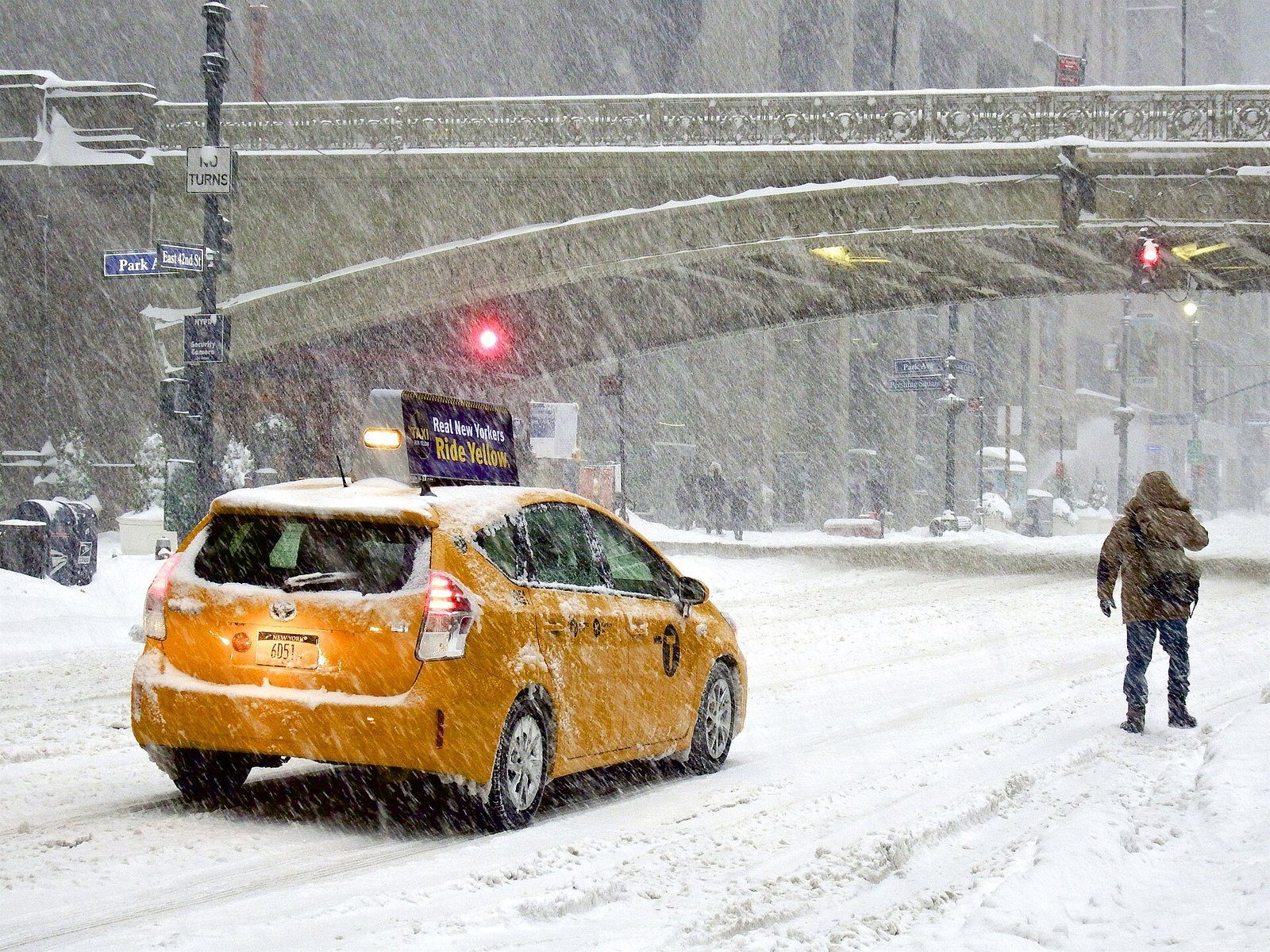
- New York City: 30.5 inches at JFK Airport and 27.9 at LaGuardia. Central Park's total is below. The Weather Service observed blizzard conditions across New York City and parts of northeast New Jersey.
- Westchester: 24.5 inches reported in Port Chester and 20.5 inches in Yonkers.
- Philadelphia: 22.4 inches at Philadelphia International Airport, about a whole winter's normal snow in one storm.
- Bucks County: reports of 29 to 30 inches in the upper county, including Perkasie and West Rockhill Township.
- Allentown: 31.9 inches at Lehigh Valley International Airport.
Statewide, New Jersey averaged 20.0 inches of snow for January 2016, the 7th snowiest January since 1895, and most of it came from this one storm.
Central Park's record, and why the number changed
Central Park's total got a lot of attention. Just after midnight on January 24, the Weather Service office in Upton reported a storm total of 26.8 inches, only 0.1 inch short of the park's biggest storm on record: 26.9 inches on February 11 and 12, 2006. The 26.6 inches that fell on January 23 alone set a new all-time record for one calendar day.
That total was later revised. The Weather Service's official figure is now 27.5 inches, which made it the largest snowstorm at Central Park since records began in 1869, ahead of the 26.9 inches from 2006. As of the Weather Service's list updated January 1, 2026, it is still number one. Early totals often get small corrections after a storm, especially when wind makes snow hard to measure.
Wind, blizzard conditions and the shore
A blizzard is about wind and visibility, not snow totals: winds frequently at or above 35 mph and visibility under a quarter mile for at least three hours in a row. Sheltered spots almost never meet that test, but the State Climatologist judged it fair to call this a blizzard across New Jersey. Peak gusts included 64 mph at Harvey Cedars (Ocean County), 60 mph at Sea Girt (Monmouth), 59 mph at Sea Isle City and 58 mph at Atlantic City Airport. Winds that widespread had not been seen since Sandy in 2012.
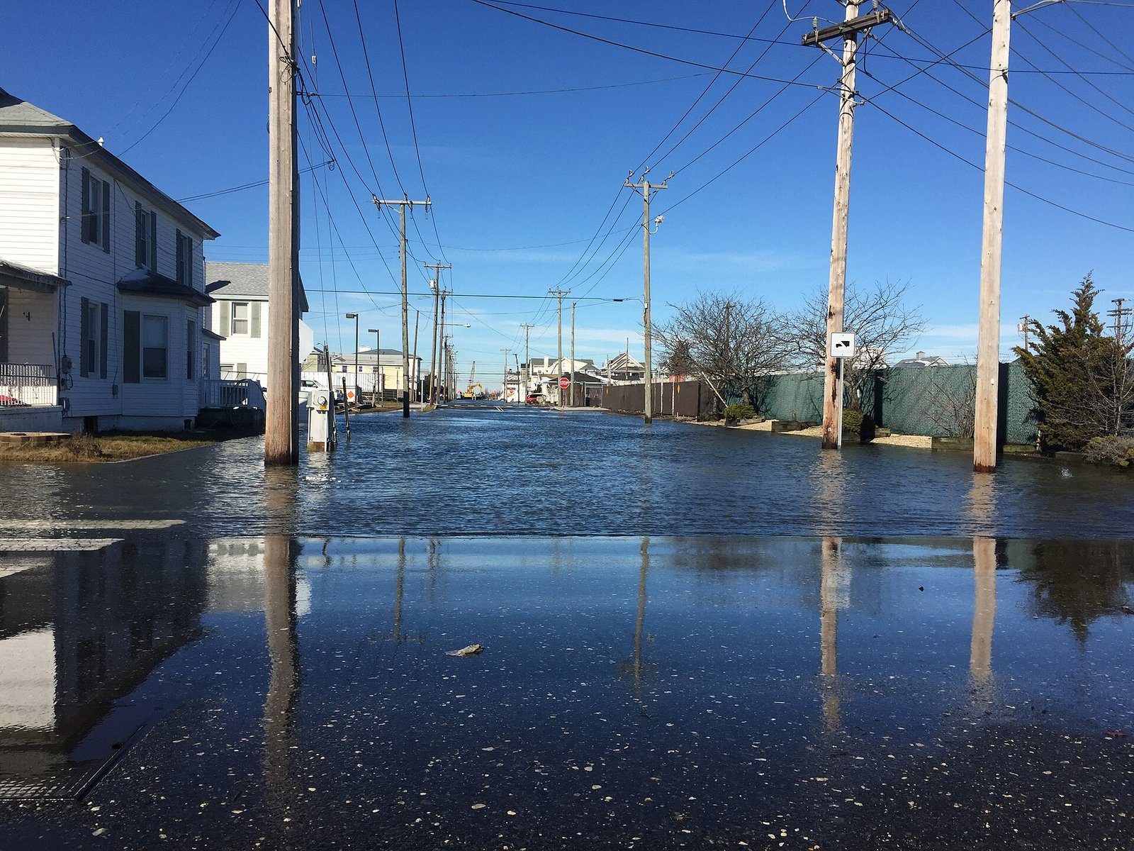
That wind piled the ocean into the coast. On Saturday morning, January 23, the Weather Service reported widespread moderate to major coastal flooding in Cape May and Cumberland counties, with waves of 18 to 22 feet just offshore. Flooding came with three high tides in a row, and forecasters expected the later two to run lower than Saturday morning's. The State Climatologist found that water levels in Cape May County went higher than during Sandy and ranked in the top 10 on record. Beach erosion was moderate to major from the central shore south. The big difference from Sandy was damage: the southern shore did not see Sandy's massive destruction.
Power outages stayed fairly limited because the snow was not the heavy, wet kind and the wind kept it from building up on branches and wires. Sadly, eight New Jersey residents died in storm-related incidents.
How well was it forecast?
The big picture was forecast well, days ahead. The Weather Service in Mount Holly issued a Winter Storm Watch on Wednesday afternoon, January 20, about two days before the first flakes, calling for 12 to 16 inches near the I-95 corridor. It upgraded to a Blizzard Watch on Thursday morning and a Blizzard Warning before dawn on Friday, January 22, with 12 to 18 inches forecast. By Friday afternoon that was 18 to 24 inches, and by Saturday morning up to 30 inches north and west of Philadelphia.
The New York City forecast was harder. Upton issued a Blizzard Watch early Thursday and a Blizzard Warning early Friday, but when the warning went out the forecast for the city and northeast New Jersey was 6 to 10 inches. It rose to 10 to 18 inches Friday afternoon, 16 to 22 inches Friday night and 24 to 28 inches by Saturday afternoon, when the snow was already falling. The northern edge of a big coastal storm is often the hardest part to pin down, which is why snow forecasts change as a storm gets closer.
Could it happen again?
Yes. Twenty years apart, the 1996 and 2016 blizzards each put about 2 feet or more on much of our area, and in 2016 several towns topped their 1996 totals. A few things to remember for the next one:
- Watch the trend, not one forecast. Totals near the edge of the heavy snow can jump by a foot in the last 24 hours.
- Snowstorms can flood the shore. A strong nor'easter can push tides to Sandy-like levels in Cape May County even while it snows.
- Expect big differences over short distances. In 2016, Sussex County got 6 inches while Morris County got 30.
- January 2016 Recap (Office of the NJ State Climatologist, Rutgers)
- 22-24 January 2016 Major Winter Storm Summary (NWS Mount Holly)
- January 22-24, 2016 Blizzard (NWS New York, NY)
- NWS Upton Record Event Report: Central Park, Jan. 24, 2016 (archived text)
- NWS Upton and Mount Holly Winter Storm and Coastal Hazard Messages, Jan. 20-25, 2016 (archived text)
- Biggest Snowstorms (One Foot or More) at Central Park, 1869 to Present (NWS New York, NY)
For dangerous weather, always follow official National Weather Service warnings and your local emergency officials.