
Weather 101 / Winter
Why the Rain-Snow Line So Often Sits on I-95
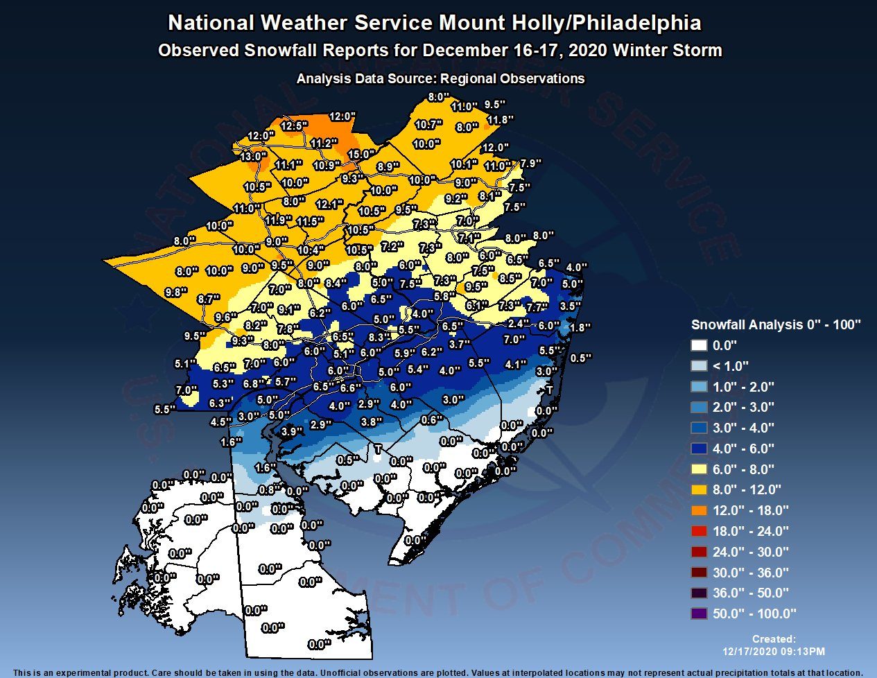
It's one of the most New Jersey things about winter: a storm comes through, Sussex County gets a foot of snow, Newark gets a slushy inch, and the shore just gets wet. The dividing line between snow and rain shows up in roughly the same place over and over, close to the Interstate 95 and New Jersey Turnpike corridor. That's not a coincidence.
Reason 1: The ocean
In winter, the Atlantic Ocean is much milder than the land. When a storm's winds blow in off the water (and in a nor'easter, they do), they carry that milder air inland. The air warms up the most right along the coast and loses that ocean warmth as it moves inland. So the shore is the first place to change over to rain, and the farther northwest you go, the better your chance of staying all snow.
Reason 2: The land itself
In New Jersey, I-95 and the Turnpike run close to the Fall Line, the boundary between the hilly Piedmont to the northwest and the low, flat Coastal Plain to the southeast. Trenton grew up right on it, at the falls of the Delaware River. Southeast of the line, the land is low and close to the ocean. Northwest of it, the land climbs into the Highlands and the Kittatinny Ridge, home to High Point, the highest spot in the state at 1,803 feet. Higher ground is colder, so even a few hundred feet of elevation can mean the difference between rain and snow when the temperature is close to freezing.
Reason 3: The cities
Newark, New York, Trenton and Philadelphia all sit along the corridor, and big cities hold heat. Pavement and buildings soak up warmth and give it back, and the city itself puts off heat. That “urban heat island” is usually only worth a degree or two, but in a storm hovering right around 32°, a degree or two is the whole ballgame.
It's not just the temperature on the ground
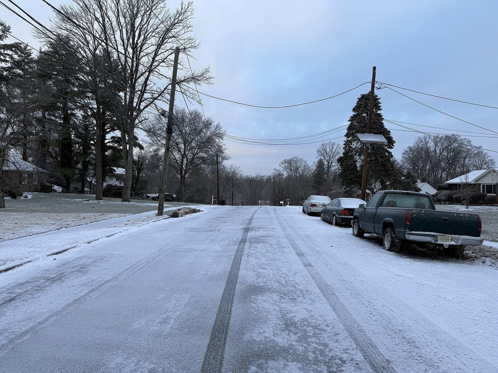
What falls out of the sky depends on the temperature all the way up, not just at street level. Snow forms high in the clouds. What happens to it on the way down decides what you get:
- Snow: the air is below freezing all the way down, so the snowflakes reach the ground as snow.
- Sleet: a layer of warmer air a few thousand feet up partly or fully melts the snowflakes, then a thick layer of cold air near the ground refreezes the drops into little ice pellets before they land. Sleet bounces and piles up like gravel.
- Freezing rain: same warm layer up high, but the cold layer near the ground is too shallow to refreeze the drops in the air. They land as liquid and freeze on contact with cold roads, trees and power lines. This is the ice storm, and it's often the most dangerous of the four.
- Rain: the air near the ground is warm enough that everything stays liquid.
In a typical New Jersey storm, all four can be happening at the same time in different parts of the state, often lined up in bands from the shore (rain) through the I-95 corridor (sleet and freezing rain) to the northwest (snow).
Why it's so hard to forecast
The rain-snow line is where snow forecasts go wrong most often. A storm that tracks 25 miles farther west, or a warm layer that's just a degree warmer than expected, can turn a 10-inch forecast into 3 inches of slush for millions of people. That's why snowfall forecasts for the I-95 cities often come as a range, and why the totals near the line keep getting updated until the storm starts.
How we show it
Our snowfall maps are built for exactly this. The color bands show who gets how much, and you'll usually see the totals drop off quickly from northwest to southeast across the corridor. When a storm is mixing, the write-up will say where we expect the changeover and when.
- NWS Northern Indiana: sleet vs. freezing rain
- NWS La Crosse: why we get a wintry mix
- NJ Division of Parks and Forestry: High Point State Park (1,803 feet)
For dangerous weather, always follow official National Weather Service warnings and your local emergency officials.