
Weather 101 / History
The Thanksgiving Storm of 1950: New Jersey's Strongest Gust and a Turning Point for Forecasting
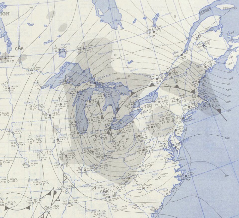
Thanksgiving weekend in 1950 brought one of the most violent storms the Northeast has ever seen. Weather historians call it the Great Appalachian Storm. It formed on November 24 and moved north through the Appalachians, bringing record snow and cold to the west of the mountains and destructive wind and flooding to the East Coast. Across the eastern United States, it killed more than 150 people.
What it did to New Jersey
- New Jersey's strongest wind gust on record: 108 mph at Newark. New York City gusted to 94 mph. Trees and power lines came down across the region.
- A record storm surge at Atlantic City. Strong onshore winds piled ocean water against the coast, flooding shore towns. Sandy Hook had a near-record surge.
When Rutgers scientists compared the great non-tropical storms with Hurricane Sandy, they found that Sandy's surge topped the 1950 storm in some places, but the 1950 storm still ranks first at Atlantic City.
The storm forecasters missed
In 1950, forecasts were drawn by hand from weather maps, and the forecasters of the day did not see how extreme this storm would be. That's where the second half of the story starts, and it happens in New Jersey.
At the Institute for Advanced Study in Princeton, a team led by meteorologist Jule Charney and mathematician John von Neumann was working on something brand new: forecasting the weather with an electronic computer. Earlier in 1950, their project produced the first weather forecast ever made by a computer. They then chose the Thanksgiving storm as the first test for their new, more advanced "two-level" model.
The results weren't as good as they hoped. But that test helped set in motion the plans that created the Joint Numerical Weather Prediction Unit in 1954, the start of everyday computer forecasting in the United States. Today, every forecast you see, including ours, starts with computer models that grew out of that work in Princeton.
Could it happen again?
Yes. Strong non-tropical storms like this one and the nor'easters we get most winters can bring damaging wind and coastal flooding without being hurricanes. The difference now is warning time: storms like this are usually spotted days ahead. Decades later, researchers even re-ran the 1950 storm on a modern forecast model to test how far ahead it can be predicted today.
- Rutgers University: Sandy's surge topped 'rogue' 1950 storm in some areas (2016)
- National Weather Service Jackson, KY: The Great Appalachian Storm of 1950
- American Meteorological Society: the Norm Phillips Symposium (the 1950 storm as the first test case for Charney's two-level model)
- IEEE Computer Society: Jule G. Charney and the IAS Meteorology Project
For dangerous weather, always follow official National Weather Service warnings and your local emergency officials.