
Weather 101 / History
The Blizzard of 1996: Philadelphia's Record 30.7 Inches and the Snowstorm That Shut Down New Jersey
In January 1996, a nor'easter buried our whole area in snow, from close to a foot along the southern Shore to nearly three feet in parts of central New Jersey. It set Philadelphia's all-time storm record, closed down travel across the region and produced a famous "state record" that later turned out to be wrong. Less than two weeks later, rain and melting snow sent rivers over their banks. Here's the story, told through the National Weather Service's own reports.
How the storm came together
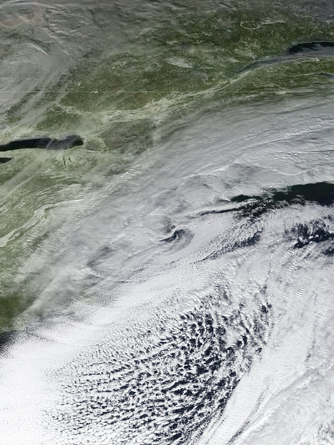
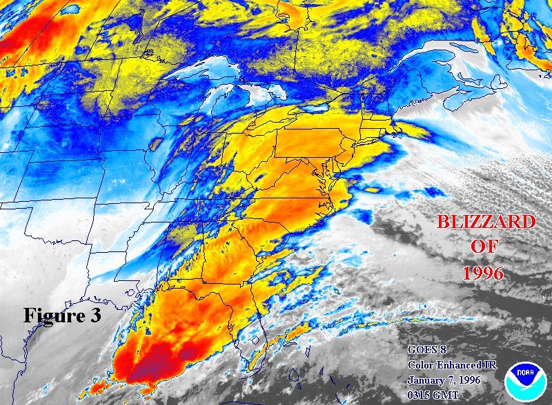
By Saturday, January 6, very cold Arctic air was in place over the Northeast. NWS forecasters in Mount Holly expected a storm to form along the Gulf Coast that day and move up the East Coast, staying all snow for nearly everyone because of the cold air. Snow began just after midnight early Sunday, January 7, in Delaware, reached South Jersey and southeastern Pennsylvania soon after, and fell heavily all day Sunday and into Monday, January 8. Strong northeast winds brought Blizzard Warnings and heavy blowing and drifting snow, the hallmarks of a classic nor'easter.
How much snow fell
These are storm totals from NWS Mount Holly and NWS New York, issued January 8 and 9, 1996, with corrections noted.
- Middlesex and Union counties: Edison 32 inches, Elizabeth 28.8.
- Camden and Burlington counties: Cherry Hill 33 inches, McGuire Air Force Base 27, Mount Holly 19.5.
- Hunterdon County: White House Station 30 inches (first reported as 35; see below), Califon 26, Flemington 19.
- Monmouth County: Hazlet 29.8 inches.
- Hudson and Essex counties: Jersey City 29.4 inches, Newark Airport 27.8 (a record for the airport), Harrison 27.
- Morris, Warren and Sussex counties: Long Valley 28 inches, Hackettstown 27, High Point 25.
- South Jersey: less, as forecasters expected some mixing near the coast. Millville 15 inches, Pomona 14.6, Atlantic City 12 and Vineland 9.
- New York City: Central Park 20.2 inches, Staten Island 27.5, the Bronx 25, Queens 24.5, LaGuardia 24, Brooklyn 23.7 and JFK 21.2.
- Westchester County: Mount Vernon 28 inches, Yonkers 26.5, White Plains 24.
- Philadelphia and Bucks County: Philadelphia International Airport 30.7 inches, Northeast Philadelphia 35, Perkasie 30, Southampton 25, Doylestown 19.
Philadelphia's all-time record
The 30.7 inches at Philadelphia International Airport broke several city records at once, according to NWS Mount Holly. It beat the old single-storm record of 21.3 inches from February 11 and 12, 1983. The 27.6 inches that fell on Sunday, January 7, set a record for one calendar day, and the 27.6 inches on the ground became the deepest snow cover on record. Another 2.6 inches on January 12 pushed the January total to 33.7 inches, the snowiest month in Philadelphia's records at the time.
The 35-inch "state record" that wasn't
Early on January 9, NWS Mount Holly announced that 35 inches had fallen at White House Station in Hunterdon County, which would have beaten New Jersey's long-cited record of 34 inches at Cape May in February 1899. The number spread quickly. But State Climatologist David Robinson questioned it, and Mount Holly's staff found the observer had pushed the measuring stick through the new snow into older snow underneath. The total was corrected to 30.0 inches in the official Storm Data publication.
In 2026, a State Climate Extremes Committee convened by NOAA reviewed New Jersey's snowstorm records and set a 48-hour state record of 34.0 inches at Oak Ridge Reservoir in Passaic County, from December 26 and 27, 1947. Edison's 32 inches remains one of the largest totals reported in the 1996 storm.
Travel shuts down
A State of Emergency was declared for New Jersey, eastern Pennsylvania and Delaware. The NWS warned before dawn Sunday that travel would be "downright dangerous," and Monday morning it was still asking people to postpone trips until officials lifted the emergency. According to the NWS review of the storm:
- Airports and trains: airports in the New York area were closed for nearly 48 hours, and the region's rail systems had similar major disruptions.
- Roads: roads in the New York area were impassable from Sunday afternoon through Monday morning. Across the Northeast, the storm shut down or hampered travel and commerce for 5 days after it ended.
- Buildings and the coast: a roof collapsed in Edison under the weight of the snow, and coastal New Jersey had moderate to locally severe flooding and erosion, with the National Guard evacuating some residents.
Death counts vary by source. NOAA's National Climatic Data Center listed 4 deaths in New Jersey and 154 in all from the snowstorm. The NWS review counted 60 known deaths, none of them in New Jersey.
How well was it forecast?
Well on the big picture, and short on the extremes. NWS Mount Holly first flagged a possible winter storm on the afternoon of Thursday, January 4. The Winter Storm Watch went out early Saturday about 24 hours ahead, calling a one-foot swath possible but describing the storm's track as "a rather big unknown." Saturday afternoon's warning called for 1 to 2 feet in southern and central New Jersey, and Sunday's Blizzard Warning raised that to around 2 feet for most of the state. Afterward, an official from New Jersey's Office of Emergency Management told the NWS its forecasts had been accurate and up to date.
Still, the biggest totals ran higher and farther north than forecast: 30.7 inches in Philadelphia and 27 to 28 inches in Warren and Morris counties, where 15 to 20 had been expected. To learn why, see why snow forecasts change.
The flood that followed
On January 17, Mount Holly expected about an inch of rain on Friday the 19th and said river flooding "seems unlikely" because the snowpack could soak up much of it. Instead, a warm, humid, windy storm on January 18 and 19 brought heavy rain and very rapid snowmelt. The NWS issued a flood watch for parts of New Jersey on Thursday afternoon, January 18, and for the rest of the state early Friday. The Delaware River had its highest crest since the 1955 floods from Hurricanes Connie and Diane. Peaks from the NWS river summary included:
- Raritan River at Bound Brook: 33.31 feet, more than 7 feet above flood stage.
- Raritan River at Manville: 19.94 feet, nearly 8 feet over flood stage.
- Millstone River at Blackwells Mills: 15.16 feet, about 6 feet over flood stage.
- Delaware River at Trenton: just over 22 feet early on January 21 (flood stage 20), and 28.72 feet at Riegelsville.
The flood killed 33 people across the Northeast, most of them in Pennsylvania and New York. Both NOAA reports list no flood deaths in New Jersey.
Could it happen again?
Yes. A strong coastal storm, deep Arctic air already in place and plenty of Atlantic moisture can come together in any winter, as the Blizzard of 2016 showed. Two lessons from 1996 still apply. Plan for the high end of a snow forecast, because the biggest totals often top it. And treat a deep snowpack as a flood risk: when a warm, rainy storm is coming, clear the storm drains near your home and keep an eye on rivers like the Raritan, Passaic and Delaware.
- NWS Philadelphia/Mount Holly: warnings, snowfall statements, record reports and flood products, January 6 to 23, 1996 (Iowa Environmental Mesonet archive)
- NWS New York: Public Information Statements, snowfall for the snow event of January 7 and 8, 1996 (IEM archive)
- NWS Service Assessment: Blizzard of '96, January 6-8, 1996
- NWS Service Assessment: Northeast Floods of January 1996
- NOAA NCDC Technical Report 96-02: the January 1996 blizzard and ensuing flooding
- State Climate Extremes Committee Memorandum: 48-Hour State Snowfall Record for New Jersey (June 2026)
For dangerous weather, always follow official National Weather Service warnings and your local emergency officials.