
What we post / Road Conditions
Road Conditions
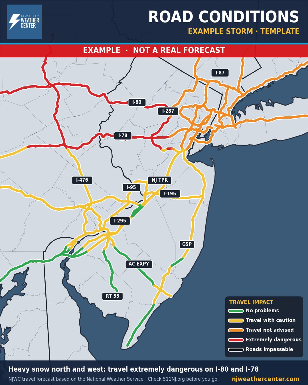
Example map. This storm is made up to show what the map looks like. It is not a real forecast.
What it shows
How bad driving will be on the major highways around us during a storm: the Turnpike, Parkway, I-95, I-78, I-80, I-287, I-295, I-195, the AC Expressway, Route 55 and the main roads into NYC, Westchester and Philly.
How to read it
- Each highway is colored by how dangerous travel will be in that part of the region.
- Green: no problems. Yellow: travel with caution. Orange: travel not advised. Red: travel will be extremely dangerous.
- Black means roads will be impassable. We save that for rare, historic storms.
- This is our forecast of conditions, not a road closure list. Before you go, check 511NJ (or 511NY / 511PA) for closures and crashes.
When we post it
Before and during snowstorms, ice storms, flooding rain and other storms that make driving dangerous.
Where the numbers come from
Our travel forecast, based on the National Weather Service forecast and its watches and warnings. Highway lines from the US Census Bureau. For dangerous weather, always follow official National Weather Service warnings and your local emergency officials.