Second Call: Sunday's coastal storm trends offshore, about 1 to 1.5 inches of rain
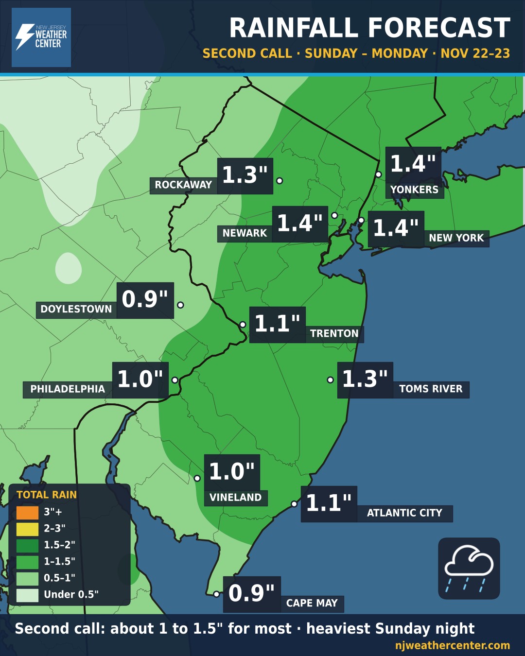
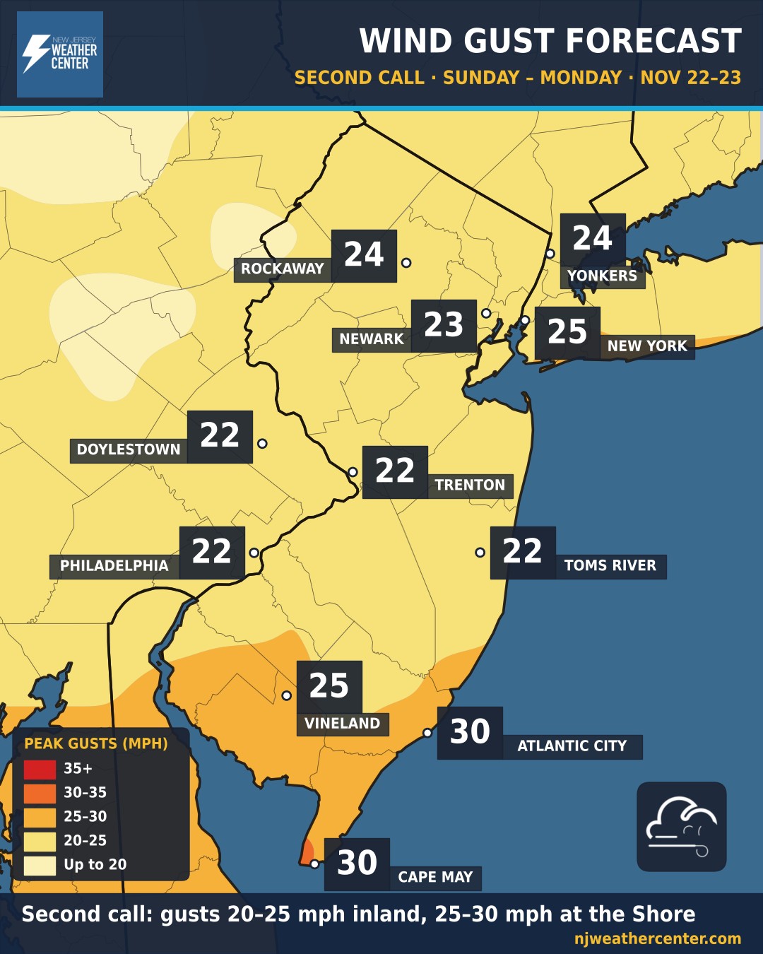
The threats: rain, heavy at times, from Sunday afternoon into Monday morning, with about 1 to 1.5 inches for most of New Jersey, New York City and Philadelphia. The heaviest rain falls Sunday night. Gusts of 20 to 25 mph inland and 25 to 30 mph at the Jersey Shore. Watch for ponding on roads and poor-drainage flooding Sunday night; the Weather Prediction Center has a Marginal Risk of flooding rain for most of the area.
Why the numbers came down: since our First Call on Friday, the computer models have shifted the storm farther east, out over the ocean. That keeps the heaviest rain and strongest winds offshore. For this Second Call we took the middle value from five models (the American GFS and its ensemble, the Canadian and its ensemble, and the European) together with the National Weather Service forecast for each town, so one model's extreme run doesn't drive the forecast.
Town by town: Newark, Yonkers and New York City about 1.4 inches; Rockaway and Toms River 1.3; Trenton and Atlantic City 1.1; Philadelphia and Vineland 1.0; Doylestown and Cape May 0.9. Peak gusts: Atlantic City and Cape May 30 mph; New York City and Vineland 25; Rockaway and Yonkers 24; Newark 23; Trenton, Doylestown, Philadelphia and Toms River 22.
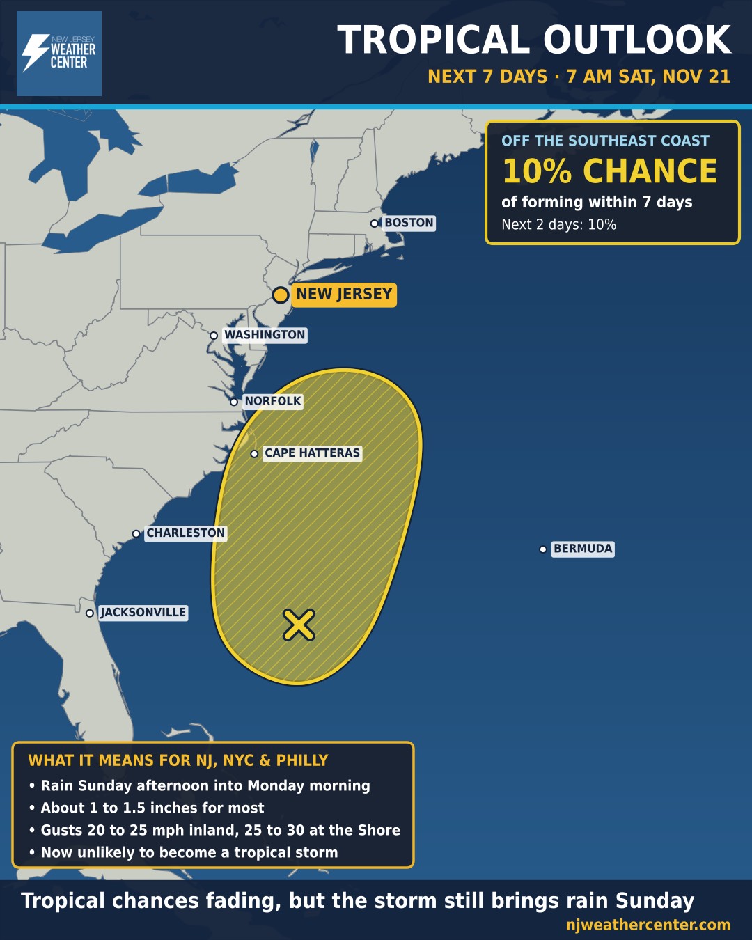
Tropical chances fading: the National Hurricane Center now gives the storm only a 10% chance of becoming a subtropical or tropical storm, down from 60% on Thursday. It's still expected to bring gusty winds, rough surf and rip currents along the coast.
Coastal flooding looks minimal, with only a few flood-prone back-bay spots possibly touching minor levels around Monday morning's high tide. Rain ends Monday morning, and drier, cooler air follows.
Next up: the National Weather Service is watching another possible coastal storm Wednesday night into Thanksgiving, which could bring more wind and coastal flooding. We'll keep you posted.