First Call: Sunday's potential coastal storm, with 1.5 to 2.5 inches of rain
Archived post. This was posted Fri, Nov 20, 2026, 10:28 AM ET and has been replaced by newer information. It's kept for reference, not current conditions. For the latest, see the homepage.
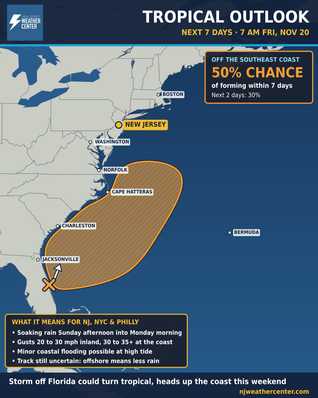
A broad area of low pressure near the east coast of central Florida will move north, near or just off the Southeast coast, through the weekend. The National Hurricane Center gives it a 30% chance of becoming a subtropical or tropical storm within 2 days and a 50% chance within 7 days.
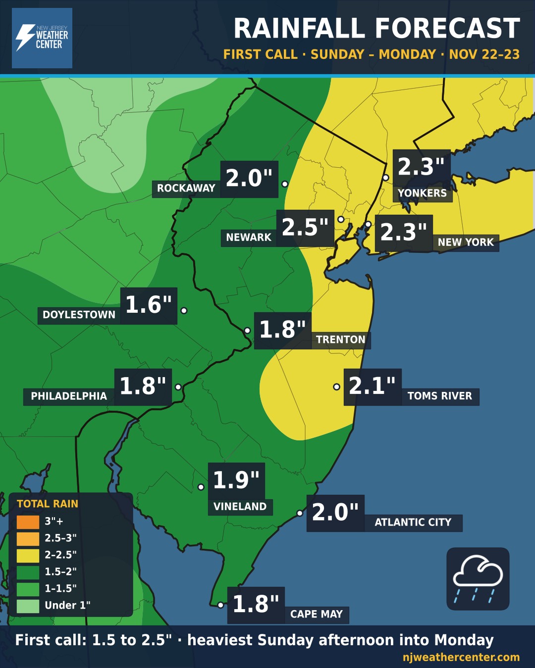
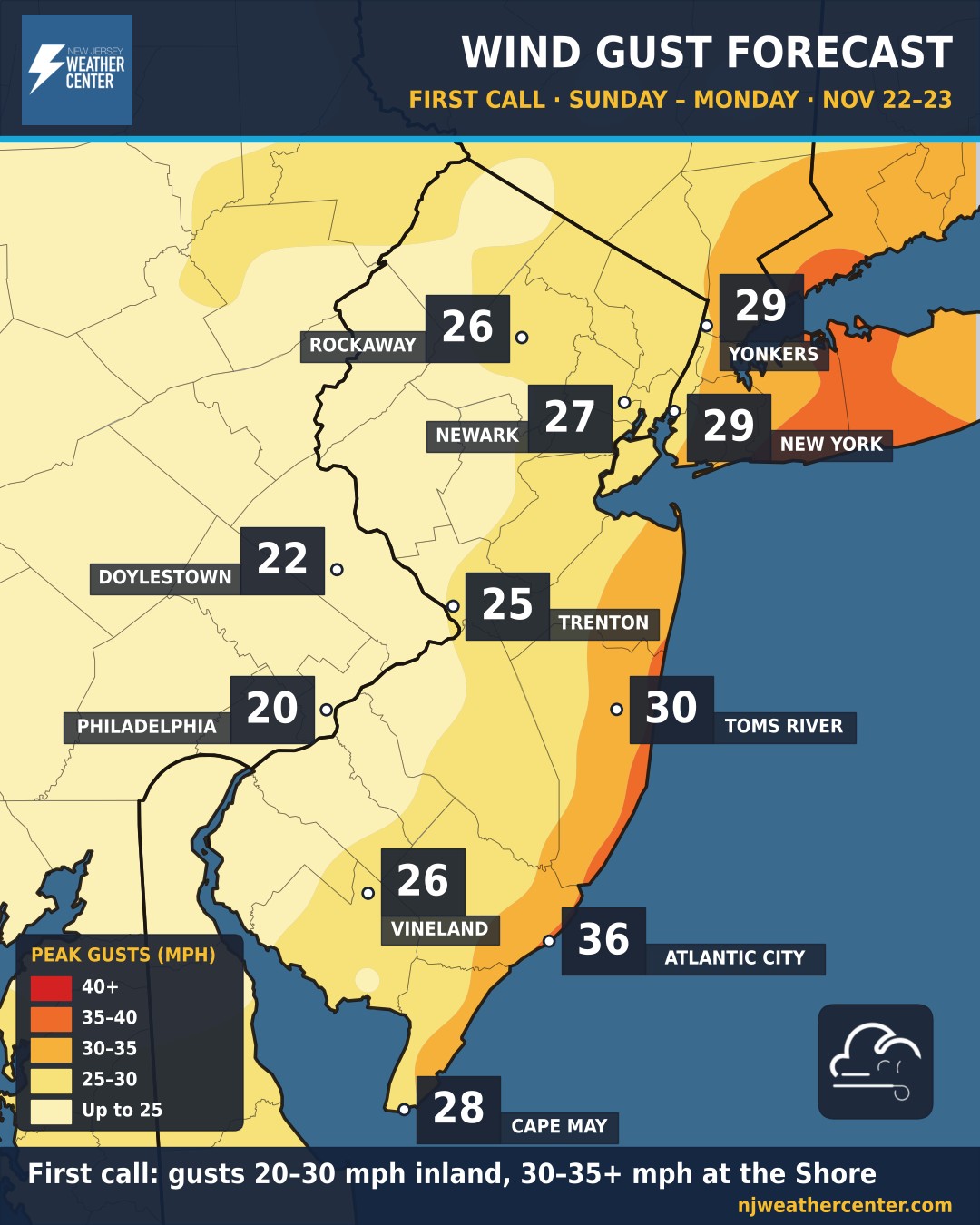
Our first call: a soaking 1.5 to 2.5 inches of rain for most of New Jersey, New York City and Philadelphia, falling mainly Sunday afternoon into Monday morning. The heaviest totals look most likely from Newark to New York City and Yonkers. Gusts of 20 to 30 mph inland and 30 to 35 mph or more at the Jersey Shore. This is a first call: the storm is still taking shape, and we'll update the numbers as the track becomes clearer.
The National Weather Service in Mount Holly says confidence is increasing in a widespread rain Sunday afternoon into early Monday, with early estimates of 1 to 2 inches areawide and a corridor of higher totals possible depending on the track. The Weather Prediction Center has a Marginal Risk of flooding rain for most of the area Sunday into Sunday night, so watch for ponding and poor-drainage flooding.
Coastal flooding: high tides run higher than usual early next week with Tuesday's full moon, so minor flooding is possible in the most flood-prone back-bay spots at high tide, depending on the storm's exact track and strength.
Behind the storm: a strong cold front crosses Monday, with gusty northwest winds Monday afternoon and much cooler air for the middle of the week. Forecasters are also watching another possible coastal storm around Thanksgiving, but that's very uncertain.
We'll update this as the National Hurricane Center issues new outlooks and as the track comes into focus.