
Tornado Watch for Central and South Jersey, Bucks and Philadelphia until 7 PM
Archived post. This was posted Thu, Nov 12, 2026, 12:58 PM ET and has been replaced by newer information. It's kept for reference, not current conditions. For the latest, see the homepage.
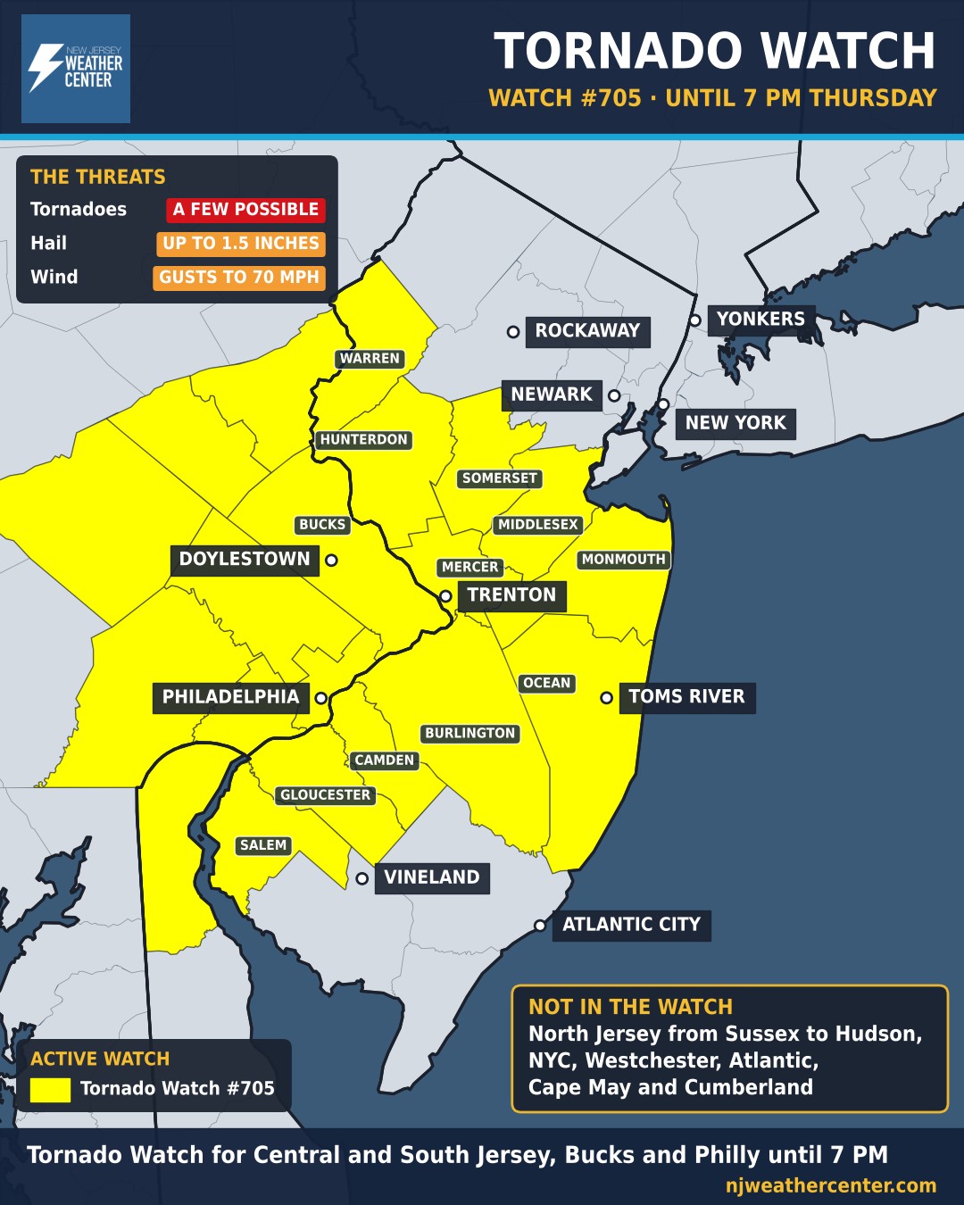
A few tornadoes are possible this afternoon and evening across Central and South Jersey, Bucks County and Philadelphia. The Storm Prediction Center's Tornado Watch 705 runs until 7 PM. Storms could also bring large hail up to 1.5 inches across, about the size of a ping-pong ball, and isolated wind gusts up to 70 mph that can bring down trees and power lines.
Why today: storms are forming near a low-pressure system and warm front moving through the area, with strong winds just above the ground that can make storms rotate. Any storm that does form will move fast, northeast at about 35 mph, so there won't be much time between a warning and the storm arriving.
What to do: a watch means conditions are favorable for tornadoes, not that one is happening. Decide now where you'd go: the lowest floor of a sturdy building, in an interior room away from windows. If a Tornado Warning is issued for your area, go there right away. The live alerts map on our homepage shows every warning the moment it's issued.
Who's in the watch: Warren, Hunterdon, Somerset, Middlesex, Mercer, Monmouth, Ocean, Burlington, Camden, Gloucester and Salem counties in New Jersey; Bucks, Philadelphia, Montgomery, Delaware, Chester, Berks, Lehigh and Northampton counties in Pennsylvania; and New Castle County, Delaware. Not in the watch: North Jersey from Sussex to Hudson, New York City, Westchester, and Atlantic, Cape May and Cumberland counties. Storms are still possible there, so keep an eye on the alerts map.