
Tornado Warning for Burlington County until 4:15 PM
Archived post. This was posted Thu, Nov 12, 2026, 3:58 PM ET and has been replaced by newer information. It's kept for reference, not current conditions. For the latest, see the homepage.
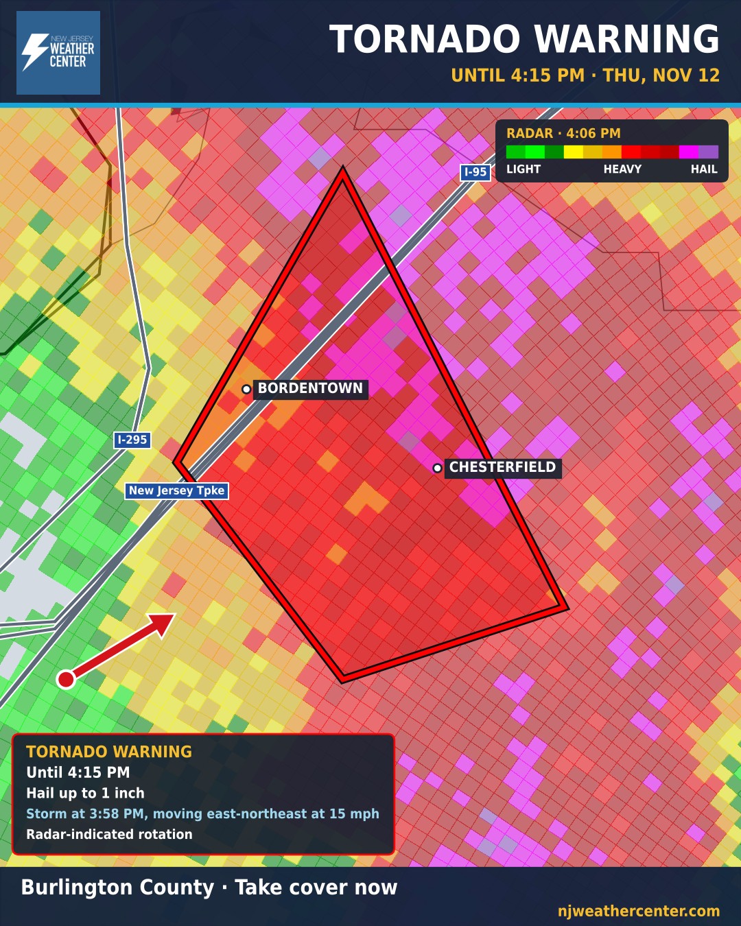
TAKE COVER NOW if you're in the warning. Radar shows a storm capable of producing a tornado. The National Weather Service issued a Tornado Warning until 4:15 PM, with hail up to 1 inch.
Go to a basement or an interior room on the lowest floor of a sturdy building, away from windows. If you're outside, in a car or in a mobile home, get to the closest sturdy building.
At 3:58 PM, a severe thunderstorm capable of producing a tornado was located over Columbus, or 9 miles south of Trenton, moving northeast at 15 mph.
What it can do: Flying debris will be dangerous to those caught without shelter. Mobile homes will be damaged or destroyed. Damage to roofs, windows, and vehicles will occur. Tree damage is likely. This tornadic thunderstorm will remain over mainly rural areas of northern Burlington County.
Roads in the warning: New Jersey Turnpike between exits 7 and 7A. The warning covers Burlington County.