
Severe Thunderstorm Warning for Camden, Gloucester, Delaware and Philadelphia counties until 3:15 PM
Archived post. This was posted Thu, Nov 12, 2026, 2:48 PM ET and has been replaced by newer information. It's kept for reference, not current conditions. For the latest, see the homepage.
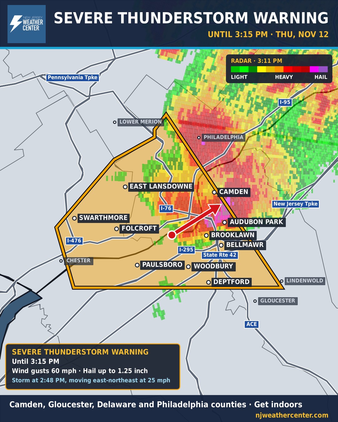
Get indoors now if you're in the warning. This storm can bring wind gusts to 60 mph and hail up to 1.25 inch. The National Weather Service issued a Severe Thunderstorm Warning until 3:15 PM.
At 2:48 PM, a severe thunderstorm was located over National Park, or near Gloucester City, moving northeast at 25 mph.
What it can do: Minor damage to vehicles is possible. Wind damage to roofs, siding, trees, and power lines is possible.
Places in the warning include Philadelphia, Camden, Gloucester City, Chester, Deptford, West Deptford, Lindenwold, Bellmawr, Yeadon, Woodbury, Folcroft, Swarthmore, Paulsboro and Magnolia. Roads in the warning: New Jersey Turnpike near exit 3; Interstate 95 in Pennsylvania between mile markers 6 and 22; Interstate 76 in Pennsylvania between mile markers 340 and 351; Interstate 76 in New Jersey between mile markers 0 and 3; Interstate 295 in New Jersey between mile markers 17 and 30; Interstate 676 in Pennsylvania between mile markers 0 and 1; Interstate 676 in New Jersey between mile markers 0 and 4; Interstate 476 in Pennsylvania between mile markers 0 and 2. The warning covers Camden, Gloucester, Delaware and Philadelphia counties.