
Rain through Friday: up to an inch or more north and east, little in South Jersey
Archived post. This was posted Thu, Nov 12, 2026, 12:02 PM ET and has been replaced by newer information. It's kept for reference, not current conditions. For the latest, see the homepage.
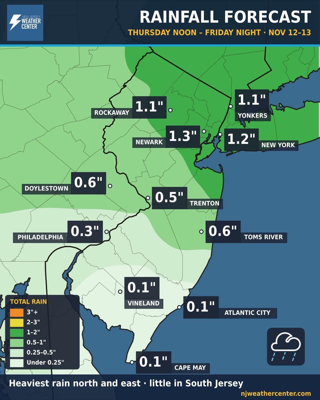
Rain and a few thunderstorms are moving through this afternoon, and it doesn't really let up until Friday night. The heaviest totals line up north and east of Trenton. Newark (1.3"), New York City (1.2"), Rockaway and Yonkers (1.1") are all looking at an inch or more from noon today through Friday night. Central Jersey runs about a half inch to an inch, while South Jersey barely gets wet: under a quarter inch for Vineland, Atlantic City and Cape May.
Thunderstorms can drop a lot more than the map shows in spots. Midday storms already put down 1 to 2 inches in northeastern Monmouth County, where the National Weather Service issued a Flash Flood Warning, and Flood Advisories went up for parts of Essex, Hudson and Union counties, Brooklyn and Staten Island. Never drive into water on the road; it takes much less than you think to float a car.
After today's warmth in the low 60s, temperatures fall through the afternoon. Friday is chilly and raw with steady rain in North Jersey and NYC, highs only in the mid 40s, and a gusty north-northeast wind up to about 25 mph. Watch for ponding on roads for both commutes.