
Radar shows a rotating storm south of Brooklyn and the Rockaways
Archived post. This was posted Thu, Nov 12, 2026, 12:53 PM ET and has been replaced by newer information. It's kept for reference, not current conditions. For the latest, see the homepage.
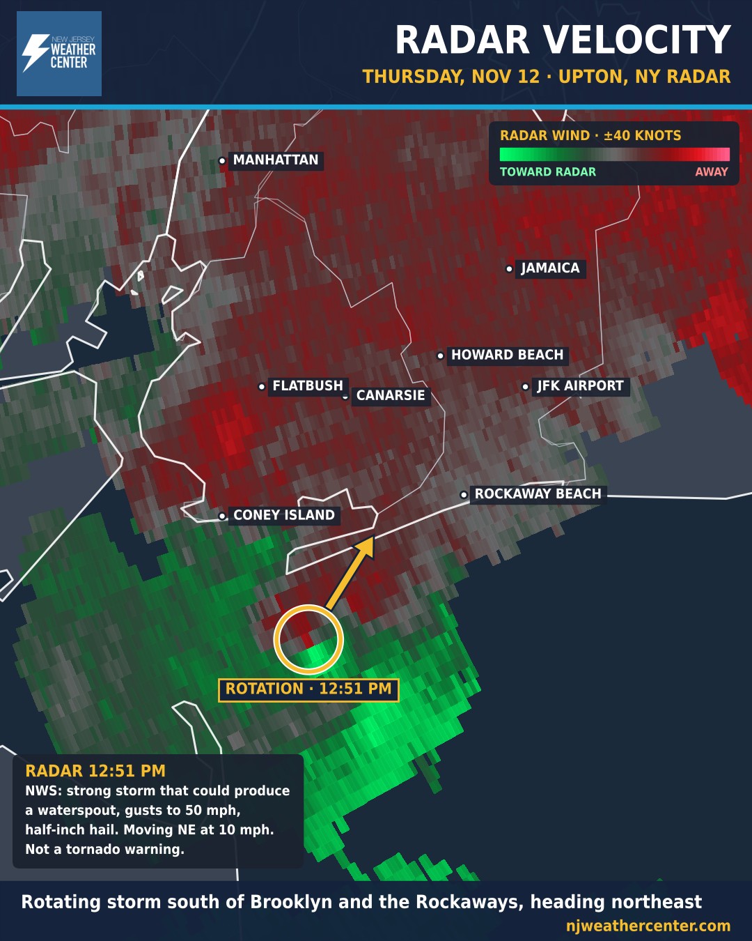
Radar is showing rotation in a thunderstorm just south of Brooklyn and the Rockaways. On this velocity map from the National Weather Service's Upton, NY radar at 12:51 PM, green shows wind blowing toward the radar and red shows wind blowing away. Where bright green sits right next to red, the storm is spinning. The circle marks that spot, just offshore between Coney Island and Rockaway Beach.
The National Weather Service issued a Special Weather Statement for Brooklyn, Queens and southern Nassau at 12:49 PM: a strong thunderstorm capable of producing a waterspout, with wind gusts up to 50 mph and half-inch hail, moving northeast at about 10 mph. Places in its path include Coney Island, Flatbush, Canarsie, Rockaway Beach, Howard Beach, Kennedy Airport and Jamaica. Special Marine Warnings are also in effect for New York Harbor and the waters off Sandy Hook and the Rockaways for possible waterspouts.
This is not a tornado warning. If a waterspout moves onshore it can act like a weak tornado, so if the storm reaches you, get inside and away from windows until it passes. The live alerts map on our homepage will show any new warning the moment the National Weather Service issues it.