
First flakes? A few wet snowflakes possible Saturday in the Poconos, Catskills and northwest NJ
Archived post. This was posted Mon, Oct 12, 2026, 2:16 PM ET and has been replaced by newer information. It's kept for reference, not current conditions. For the latest, see the homepage.
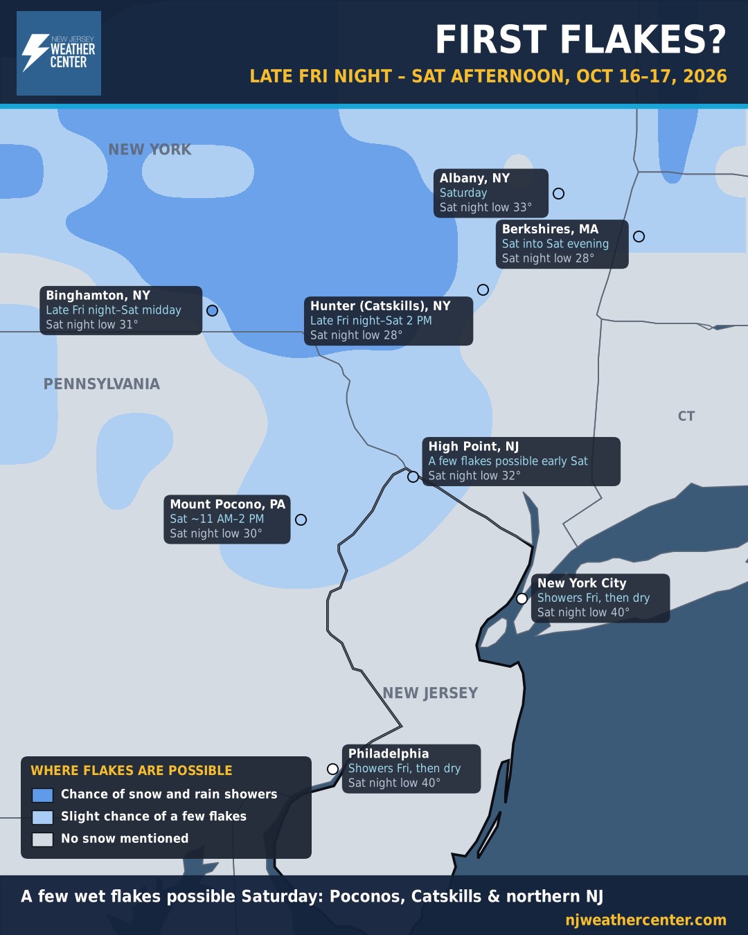
A strong cold front Friday brings showers, then much colder air. Late Friday night into Saturday, the National Weather Service has a chance of rain and snow showers in the Catskills and upstate New York, and a slight chance of a few flakes in the Poconos (Mount Pocono, about 11 AM to 2 PM Saturday) and the Berkshires.
Northern New Jersey: a slight chance of a few flakes on the high ground early Saturday morning, with temperatures in the mid to upper 30s. High Point drops to about 32° Saturday night. Elsewhere in NJ, NYC and Philly: showers Friday, then windy and chilly, with highs in the 40s and 50s Saturday.
Any flakes would be brief and mixed with rain, with nothing sticking. We'll update as the weekend gets closer.