Severe Thunderstorm Warnings for Warren, Morris, Hunterdon, Somerset, Bucks and the Hudson Valley
Archived post. This was posted Fri, Oct 16, 2026, 5:58 PM ET and has been replaced by newer information. It's kept for reference, not current conditions. For the latest, see the homepage.
The National Weather Service issued three Severe Thunderstorm Warnings for our area this evening as the line of storms moved in from Pennsylvania. Each warning carries wind gusts to 60 mph and hail up to 3/4 inch.
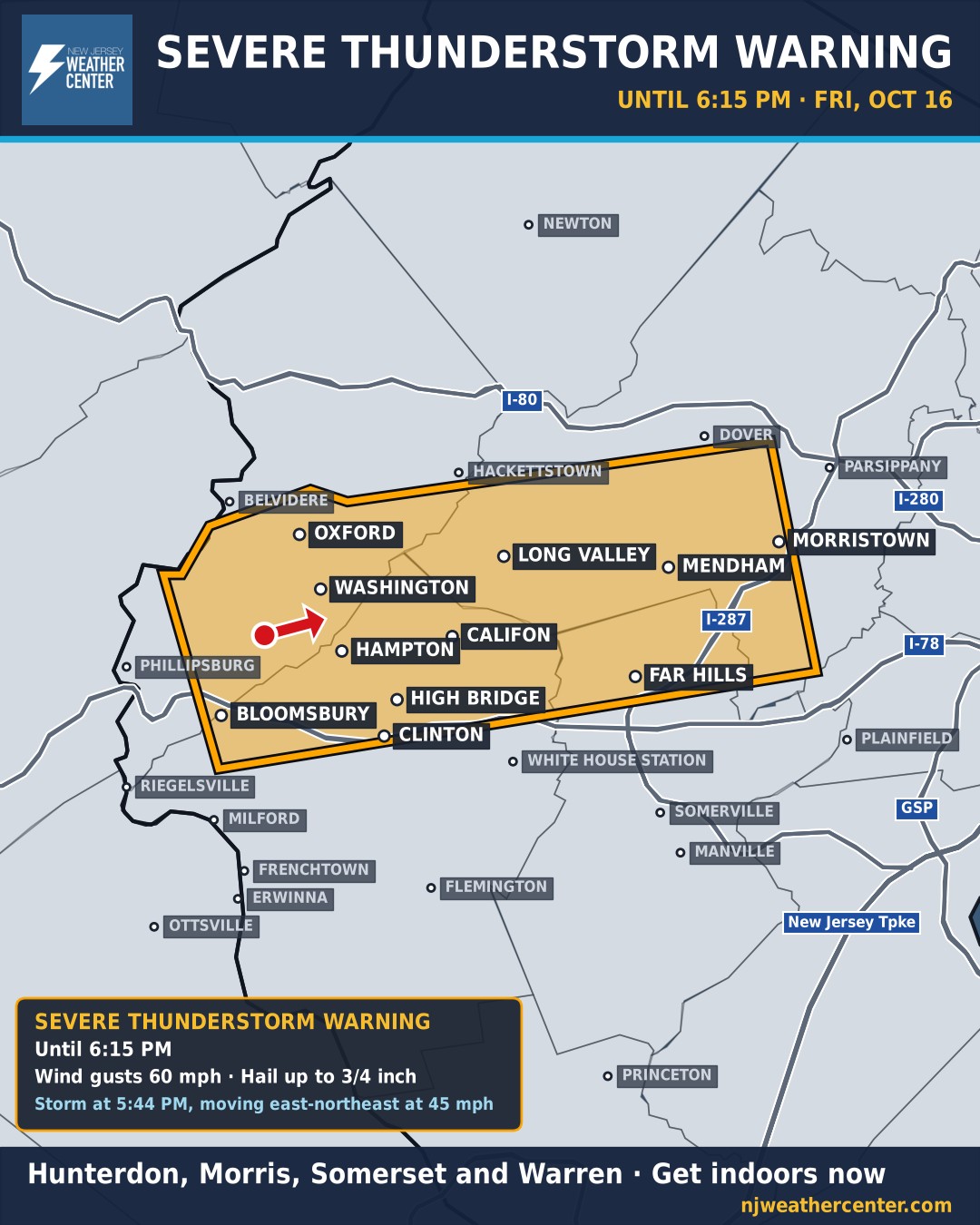
Warren, Morris, Hunterdon and Somerset counties, until 6:15 PM: the storm was moving east-northeast at 45 mph through Hackettstown, Washington, Long Valley, Califon, High Bridge and Clinton toward Mendham, Far Hills and Morristown (map above).
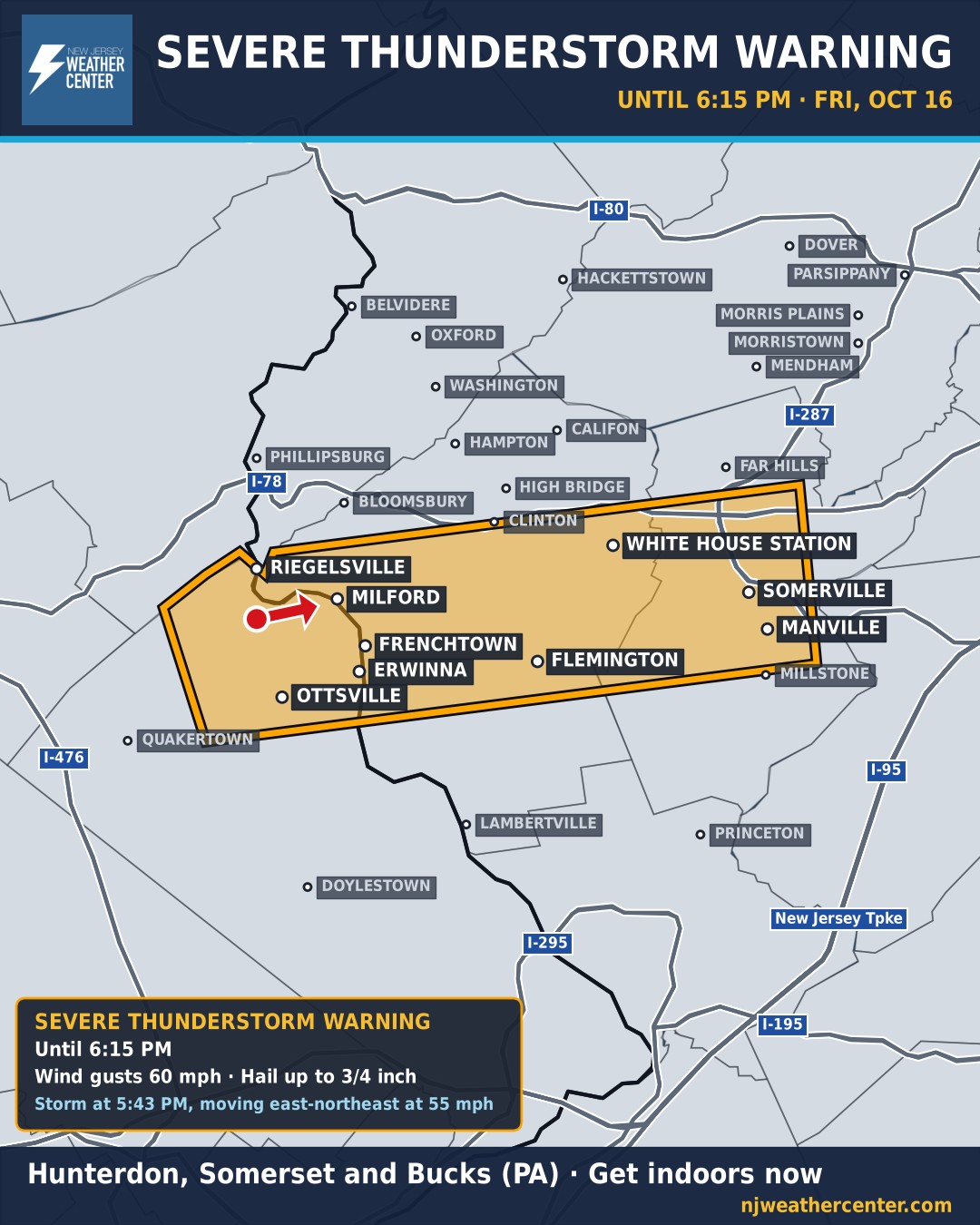
Hunterdon, Somerset and Bucks counties, until 6:15 PM: moving east-northeast at 55 mph from Riegelsville, Milford and Frenchtown toward Flemington, White House Station, Somerville and Manville (second map).
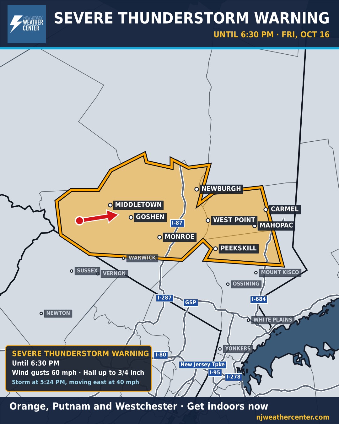
Orange and Putnam counties and northern Westchester, until 6:30 PM: moving east at 40 mph through Middletown, Goshen and Monroe toward West Point, Peekskill, Mahopac and Carmel (third map).
If you're in a warning, get indoors and away from windows. Gusts this strong can bring down trees and power lines. The rest of New Jersey, NYC and Westchester is under a Severe Thunderstorm Watch until 10 PM (Bucks and Philadelphia until 8 PM), and more warnings are likely as the line moves east. Our live alerts map checks the National Weather Service every 2 minutes and outlines every new warning.