
Friday: severe storms possible, damaging wind gusts the main threat
Archived post. This was posted Thu, Oct 15, 2026, 8:15 PM ET and has been replaced by newer information. It's kept for reference, not current conditions. For the latest, see the homepage.
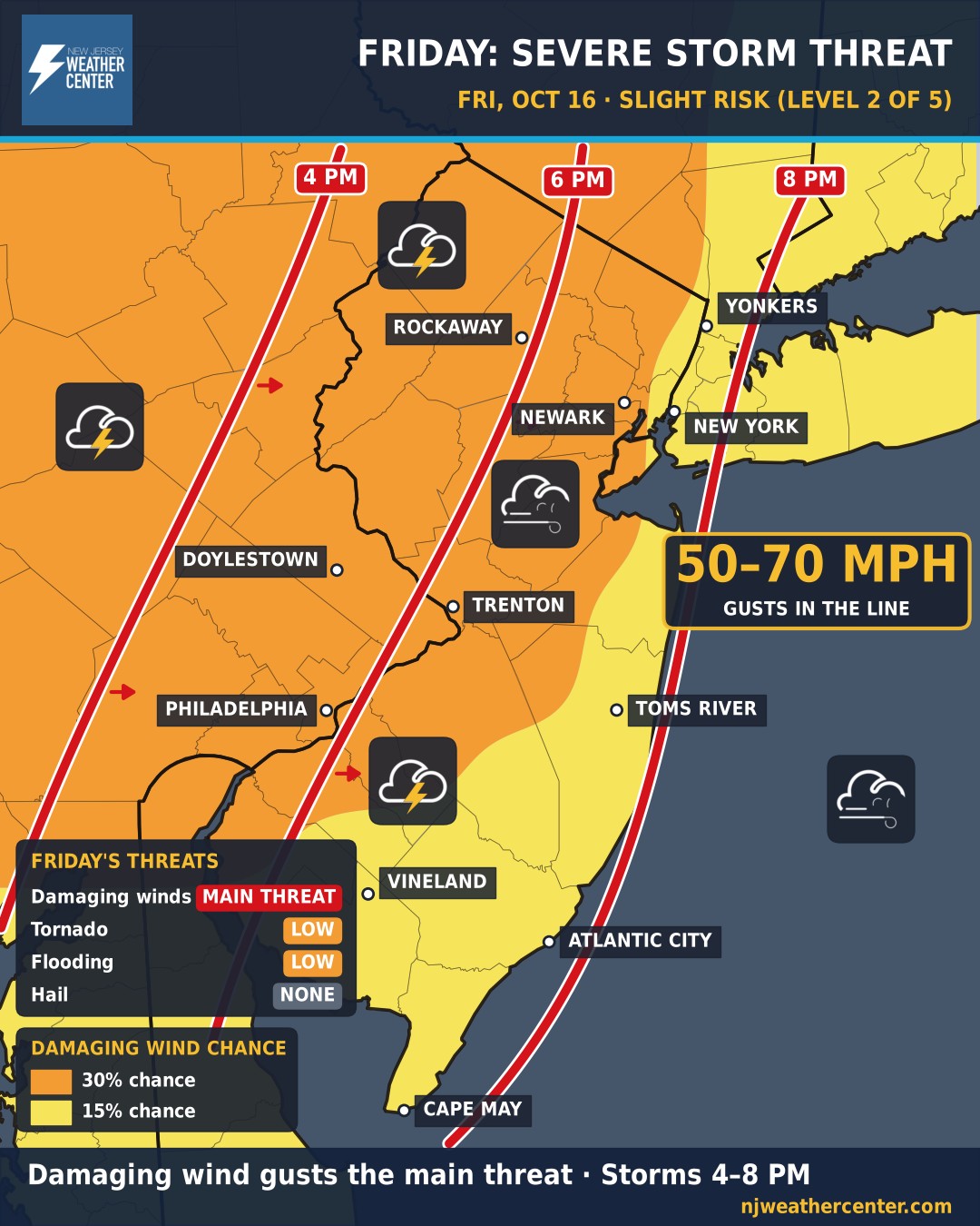
A strong cold front brings a line of storms through Friday afternoon and evening, and some could be severe. NOAA's Storm Prediction Center has the entire area under a Slight Risk (level 2 of 5).
Damaging wind gusts are the main threat. The line of storms could bring gusts of 50 to 70 mph, and isolated gusts strong enough to bring down trees and power lines. The highest chance (30%) covers North and West Jersey, Bucks County, Philadelphia and the I-95 corridor; NYC, Westchester, the shore and South Jersey are at 15%. Hail isn't expected, and the tornado risk is low, though one can't be completely ruled out.
Timing: the line arrives in the western areas around 4 to 6 PM (Doylestown, Sussex and Warren counties), reaches the I-95 corridor around 5 to 7 PM (Trenton, Philadelphia), South Jersey and the shore around 6 to 8 PM, and Newark, NYC and Westchester around 7 to 8 PM before moving offshore. The severe threat fades after sunset.
Be ready: secure outdoor furniture and Halloween decorations before the afternoon, charge your phone in case the power goes out, and head indoors when the storms arrive. Behind the front, gusty northwest winds and the coldest air of the season move in for the weekend.