
Tropical Storm Isaias: what it could mean for New Jersey (Advisory 4)
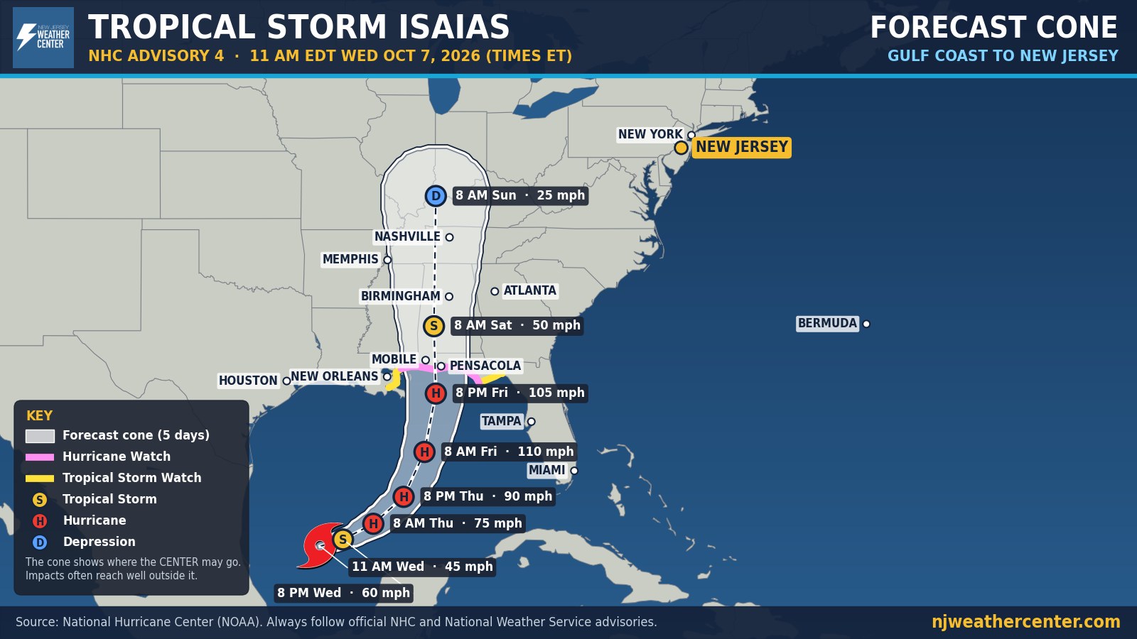
As of 11 AM Wednesday, Tropical Storm Isaias had 45 mph winds in the southern Gulf of Mexico, moving east-northeast at 8 mph. The National Hurricane Center expects quick strengthening: a hurricane on Thursday and a peak near 110 mph early Friday.
The forecast track curves north toward the Gulf Coast, reaching the coast near Mobile and Pensacola Friday night. From there it weakens over Alabama on Saturday and becomes a depression by Sunday. The cone, which shows where the center could go, stays well west of us.
For us: no direct hit from Isaias. The rest of the week stays quiet and dry. What's left of the storm is expected to bring rain as early as Sunday. The National Weather Service in Mount Holly says it could carry a lot of tropical moisture, so rain may be heavy at times, with some spots picking up 1 to 2 inches. The exact timing is still uncertain because the computer models disagree on how fast it gets here. We'll narrow down timing and totals over the next few days.
Watches are now up on the Gulf Coast: a Hurricane Watch from Bay St. Louis, Mississippi to Indian Pass, Florida; a Storm Surge Watch from the mouth of the Mississippi River to Yankeetown, Florida; and Tropical Storm Watches on either side. Nothing is in effect for our area. We update this map with every new advisory.