
Frost to start, 70° by the afternoon
Archived post. This was posted Wed, Oct 7, 2026 and has been replaced by newer information. It's kept for reference, not current conditions. For the latest, see the homepage.
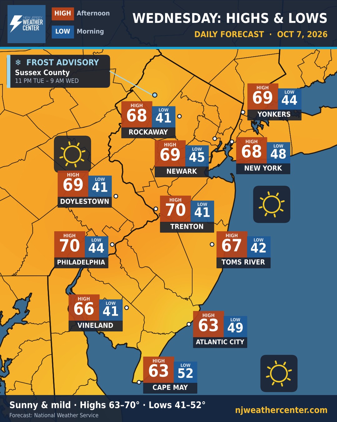
Clear skies and light winds tonight let the day's warmth escape fast, so Wednesday starts cold. Most of us wake up in the low 40s, and Newton in Sussex County drops to about 36°.
Then the sun takes over. Highs reach the upper 60s to near 70 inland, and the low 60s at the shore. That's a swing of about 30 degrees in some spots. The ocean keeps Cape May to only an 11-degree swing.
Frost Advisory for Sussex County from 11 PM Tuesday until 9 AM Wednesday, with temperatures as low as 33° in spots. Cover or bring in sensitive plants.
Low / High: Rockaway 41° / 68° · Yonkers 44° / 69° · Newark 45° / 69° · New York 48° / 68° · Trenton 41° / 70° · Philadelphia 44° / 70° · Toms River 42° / 67° · Cape May 52° / 63°