ALERTSDaily forecast maps are back. For current watches and warnings, always check weather.gov.
New Jersey Weather Center logo New JerseyWeather Center

Archive › Long range

Archived · Long range · Mon, Oct 5, 2026 (for Oct 13–19)

Mid-October looks seasonable, with a wetter lean

Archived post. This was posted Mon, Oct 5, 2026 (for Oct 13–19) and has been replaced by newer information. It's kept for reference, not current conditions. For the latest, see the homepage.
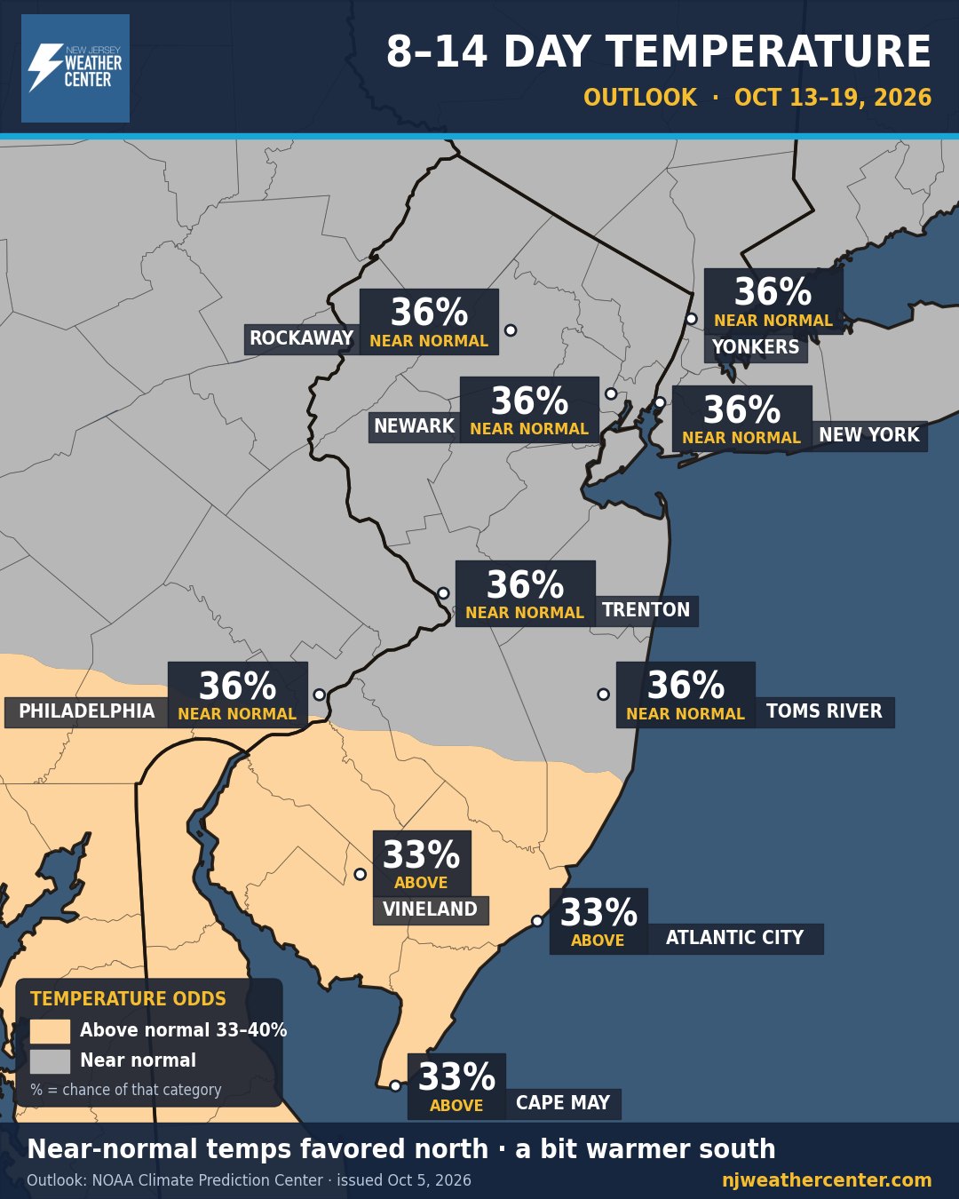
8 to 14 day temperature outlook for Oct 13 to 19, 2026 from NOAA's Climate Prediction Center: near normal favored (36 percent) for Rockaway, Yonkers, Newark, New York, Trenton, Philadelphia and Toms River; leaning above normal (33 percent) for Vineland, Atlantic City and Cape May.

This is the big-picture look at Oct 13–19. It's not a day-by-day forecast. Think of it like the odds on a game: NOAA's Climate Prediction Center gives the chance that the week as a whole runs warmer, colder, wetter or drier than normal for mid-October.

Temperatures: near normal is the best bet for North and Central Jersey, NYC and Philly. South Jersey leans just a little warmer than normal.
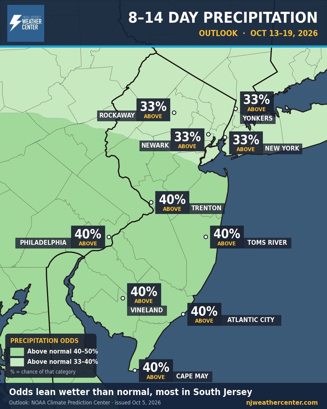
8 to 14 day precipitation outlook for Oct 13 to 19, 2026 from NOAA's Climate Prediction Center: leaning above normal, 33 percent for Rockaway, Yonkers, Newark and New York, and 40 percent for Trenton, Philadelphia, Toms River, Vineland, Atlantic City and Cape May.
8–14 day precipitation outlook, Oct 13–19.

Rain: the odds lean wetter than normal for everyone, a 40–50% chance from Trenton and Philly down to Cape May, and 33–40% up north. That doesn't mean it rains every day, just that the week tilts wet.

Outlook: NOAA Climate Prediction Center, issued Mon, Oct 5, for Oct 13–19. Maps: NJ Weather Center.