
Weather 101 / Winter
Wind Chill: What “Feels Like” Really Means in Winter
It's 20° with a 25 mph wind, and the forecast says it feels like 3°. That second number is the wind chill, and it matters more than the thermometer when you're deciding how to dress or how long to stay outside.
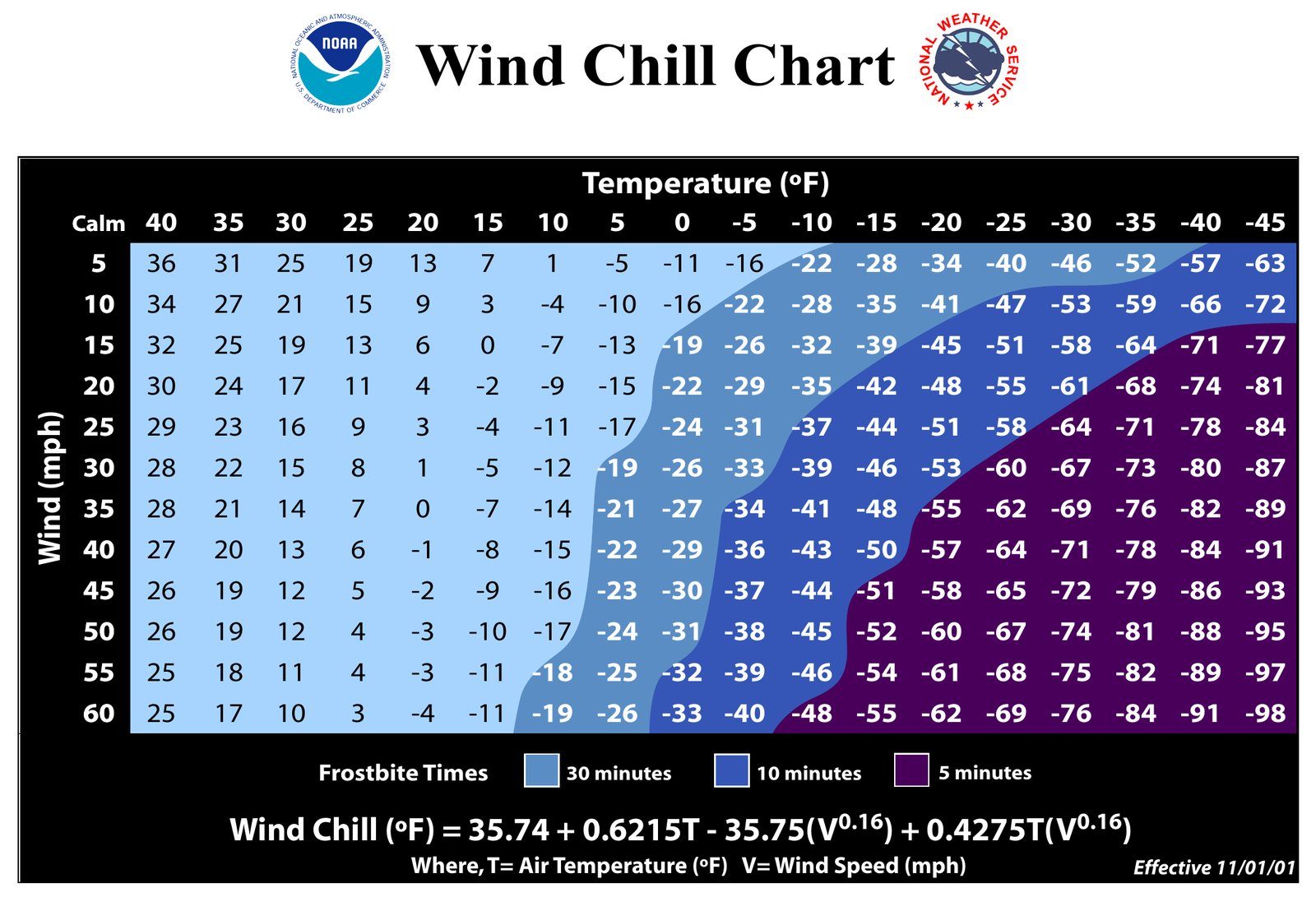
What wind chill measures
Your body keeps a thin layer of warm air right next to your skin. Wind blows that layer away, so your skin loses heat faster. The wind chill is how cold it feels on exposed skin because of that, based on the air temperature and the wind speed. The National Weather Service's current wind chill formula dates to 2001, when it replaced a much older version.
Wind chill doesn't change the actual temperature. Your car, your pipes and a puddle on the road only care about the real temperature. If it's 35° out, water won't freeze no matter how windy it is.
Frostbite and hypothermia
Frostbite only happens when the actual air temperature is below freezing, but wind makes it happen faster. The lower the wind chill, the less time exposed skin can take. Cover your face, ears and hands first, since they lose heat fastest. Hypothermia, when your whole body gets too cold, can happen even above freezing if you're wet and in the wind.
The alerts have new names
The National Weather Service renamed its cold alerts: the old Wind Chill Advisory is now a Cold Weather Advisory, and the old Wind Chill Warning is now an Extreme Cold Warning. The thresholds are set by each local office, so what triggers an alert in New Jersey is different from what triggers one in Minnesota.
How to dress
- Wear layers, with a windproof outer layer.
- Cover your head, ears, face and hands.
- Stay dry: wet clothes lose their warmth quickly.
- Bring pets inside when it's bitterly cold.
Our Heat Index & Wind Chill maps show what it will feel like town by town when it gets extreme.
For dangerous weather, always follow official National Weather Service warnings and your local emergency officials.