
Weather 101 / History
Irene 2011: New Jersey's Record Evacuation and River Floods
In late August 2011, Irene became one of the most memorable storms in New Jersey history. It forced the largest coastal evacuation the state had ever seen, came ashore on our coast, shut down New York City's subways, and flooded rivers across central and northern New Jersey to record levels. We tell the story with numbers from the National Hurricane Center, the National Weather Service, the U.S. Geological Survey and the Office of the New Jersey State Climatologist at Rutgers.
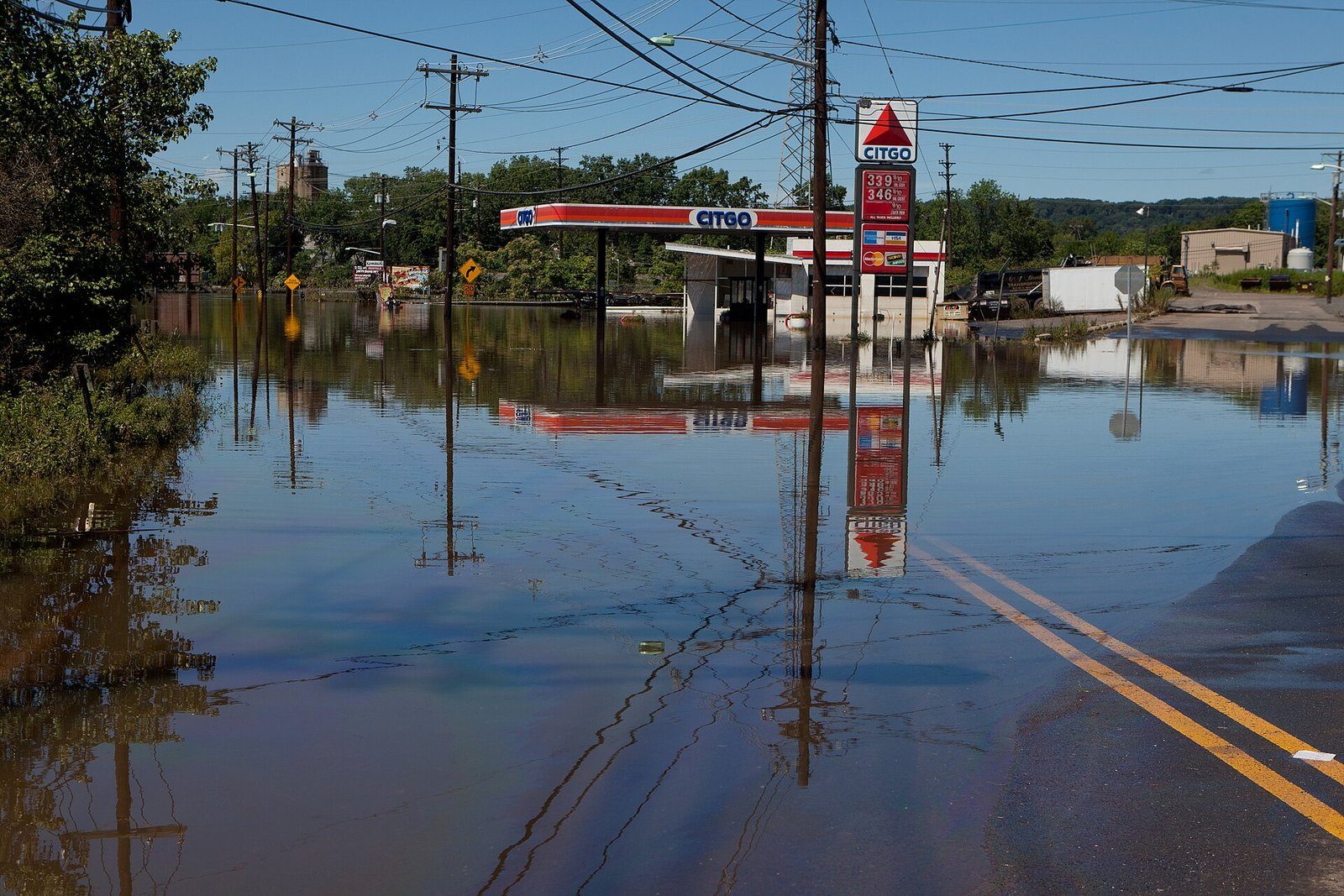
A wet August set the stage
Irene did not arrive on dry ground. In the three weeks before it, 8 to more than 16 inches of rain had fallen across New Jersey, according to the USGS. With Irene added, August 2011 became the wettest month of any kind in state records, with a statewide average of 16.64 inches. Soaked ground cannot absorb more water, so almost all of Irene's rain ran straight into streams and rivers, and trees came down easily in the wet soil.
The evacuation
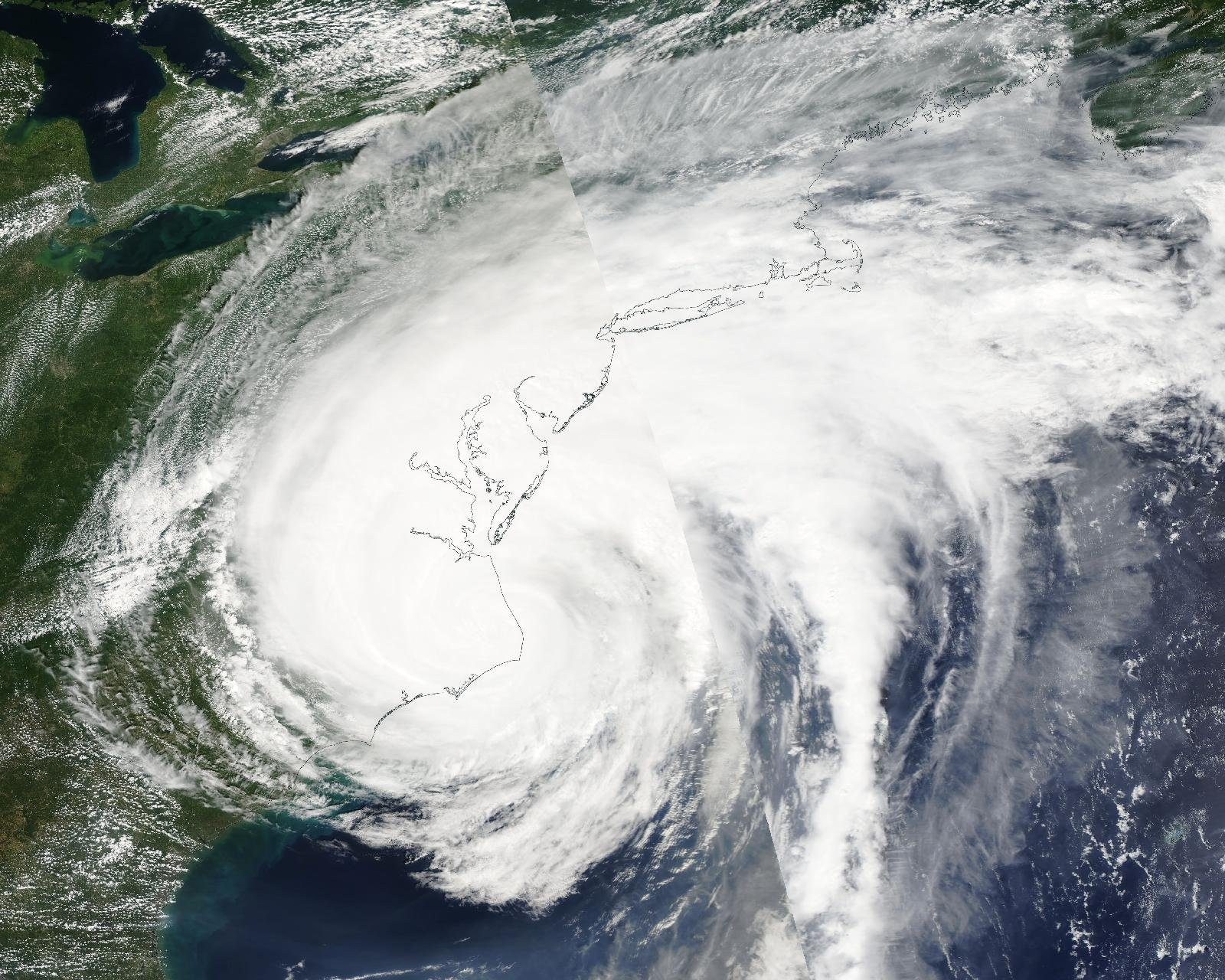
Irene was a Category 3 hurricane in the Bahamas and hit North Carolina as a Category 1. A Hurricane Warning went up for the coast all the way to Sandy Hook on August 26. Hundreds of thousands of people were ordered out of low-lying areas, including all of the barrier islands, Atlantic City and Cape May. The State Climatologist called it "an unprecedented evacuation of at least one million visitors and residents from coastal counties from Cape May to Monmouth," the largest coastal evacuation in state history. Atlantic City closed its casinos for only the third time since gambling began there in 1978.
Landfall in New Jersey
The hurricane center's final report puts Irene's New Jersey landfall at Brigantine Island, very near Atlantic City, at about 5:35 AM on Sunday, August 28. Its top winds were about 70 mph, just below hurricane strength, so it was officially a tropical storm. Other reports place the landfall a little farther north near Little Egg Inlet. Either way, the strongest winds stayed mostly over the water east of the center. The center crossed the state, went out over Raritan Bay, and moved over Coney Island in Brooklyn around 9 AM.
- Wind gusts: 69 mph at Harvey Cedars, 66 mph at the Atlantic City Marina and 65 mph at Point Pleasant Beach. Inland gusts were mostly 40 to 60 mph.
- Storm surge: 3 to 5 feet along the shore, with moderate to severe tidal flooding and heavy beach erosion.
- Power: the National Weather Service in Mount Holly counted about 1.6 million customers without power across all 21 counties, some for about a week.
The rain
Most of New Jersey got 5 to 10 inches, with a statewide average of about 7 inches. The State Climatologist ranks Irene among the three wettest rainstorms in New Jersey since 1895. The wettest spot in several counties:
- Freehold Township (Monmouth): 11.27 inches, the state's highest
- Elizabeth (Union): 10.79 inches
- Jefferson Township (Morris): 10.54 inches
- Stockton (Hunterdon): 10.32 inches
- Wayne (Passaic): 10.20 inches
- Orange (Essex): 9.96 inches
Record river floods
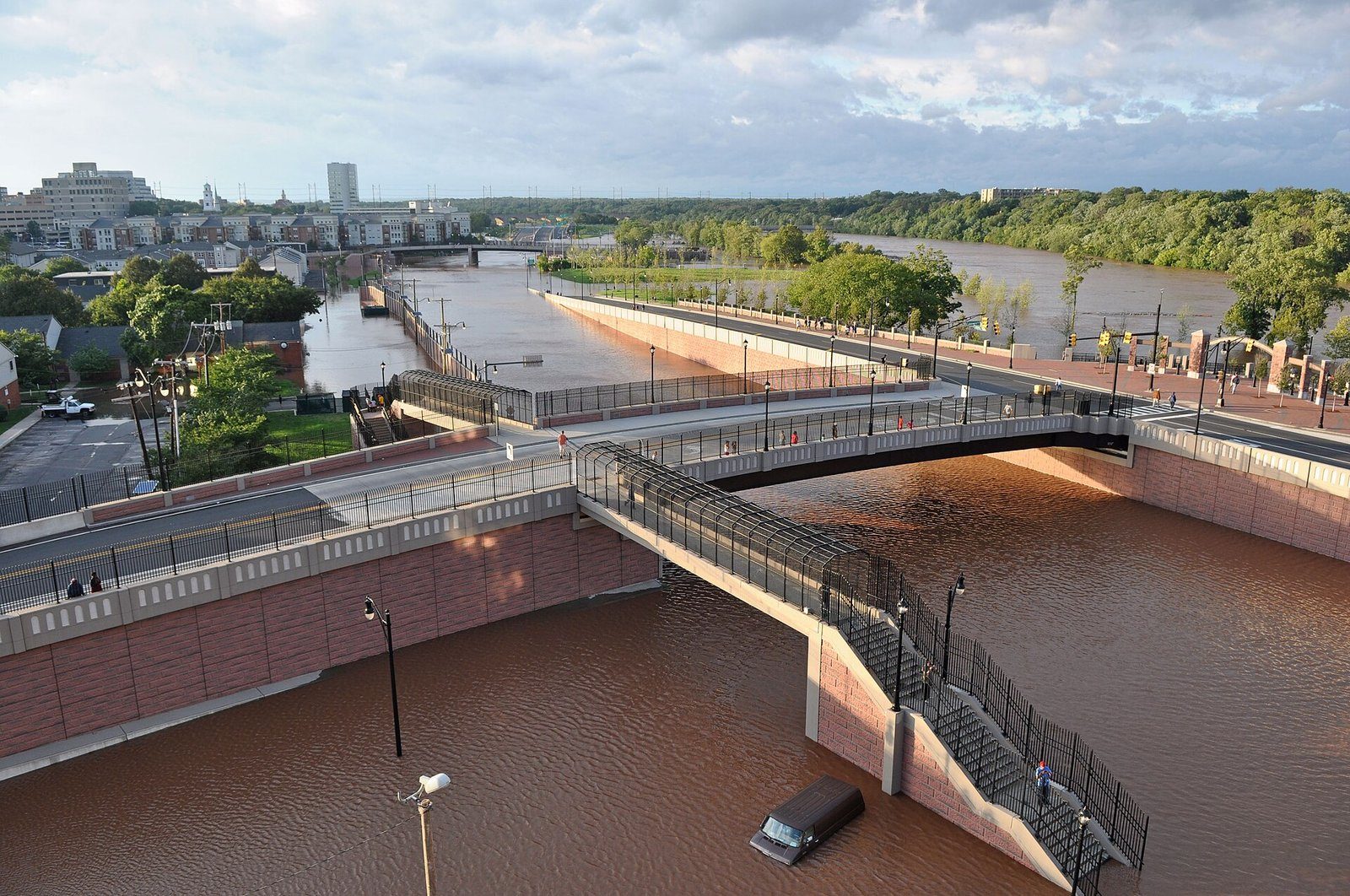
The rain ended by mid-morning on August 28, but the big rivers kept rising for days. The Raritan crested on the 29th and the Passaic not until the 30th. The USGS found new all-time peak flows at 32 long-term river gauges in New Jersey, and six dams failed. In the Passaic and Hackensack basins alone, 10 gauges set records.
- Ramapo River near Mahwah: new record, 15.77 feet and 15,000 cubic feet per second, more than 2 feet above the April 1984 record.
- Ramapo River at Pompton Lakes: new record flow of 17,800 cubic feet per second, beating April 1984.
- Pompton River at Pompton Plains: record stage of 25.24 feet according to the Weather Service. By flow, the USGS ranks it second only to October 1903.
- Passaic River at Little Falls: second-highest flow on record, behind only October 1903.
- Raritan River at Bound Brook: 41.9 feet, second only to Floyd in 1999 (42.13 feet).
- Raritan River at Manville: about 26.2 feet, second only to Floyd (27.1 feet).
- Millstone River at Blackwells Mills: record stage of 21.24 feet, just above Floyd's crest.
The Weather Service also reported record crests on the Rockaway River at Boonton, the Passaic at Millington and Pine Brook, and Assunpink Creek in Trenton, and the USGS recorded new peaks on the Rahway River. The Weather Service reported 350 New Jersey roads closed at the height of the storm, and the Rockaway River washed out lanes of Interstate 287 in Boonton.
New York City
New York City ordered its first-ever mandatory evacuation, about 350,000 residents of flood-prone areas. The Weather Service calls Irene "the first natural disaster to close the NYC subway system." Service stopped late Saturday, August 27, and did not fully return until Monday, August 29. The city shut down its entire mass transit system several hours before tropical-storm-force winds arrived, a first. Irene's strongest winds stayed east of the city, but a 3 to 6 foot surge caused property damage, and Central Park measured 6.87 inches of rain.
Philadelphia and Bucks County
Philadelphia International Airport measured 5.70 inches of rain and closed for several hours on August 28. Frankford Creek and Wissahickon Creek in Philadelphia reached major flood stage. In Bucks County, Springtown measured 7.73 inches, and Neshaminy Creek at Langhorne had its third-highest crest, 19.55 feet. An EF1 tornado with winds near 95 mph was confirmed near Quakertown. NJ Transit's Northeast Corridor line from Trenton to New York was shut for several days by flooding.
The human toll
The hurricane center counted 40 direct deaths in the United States. More than half, 21, were from freshwater flooding, compared with 13 from wind and falling trees. In New Jersey it lists 7 direct deaths, including two in Mercer County and two in Ocean County. The State Climatologist reported "the loss of life of at least a dozen NJ residents," a count that likely includes indirect deaths. The USGS estimated New Jersey's property damage at $1 billion, and every county was declared a federal disaster area.
What it means today
Irene showed two things. First, the coast was lucky: the State Climatologist noted the Shore escaped far worse damage only because Irene arrived weaker than feared. Second, a "mere" tropical storm can cause record flooding far from the ocean, especially after a wet month. When the next tropical system heads our way, watch the rain forecast as closely as the wind, and expect river towns to see their worst flooding a day or more after the rain stops. Our guide to flash flood safety covers what to do.
- Tropical Cyclone Report: Hurricane Irene (AL092011), 21-28 August 2011 (National Hurricane Center)
- Service Assessment: Hurricane Irene, August 21-30, 2011 (National Weather Service)
- Post Tropical Cyclone Report: Irene (NWS Philadelphia/Mount Holly)
- Hurricane Irene and Associated Floods of August 27-30, 2011, in New Jersey, Scientific Investigations Report 2013-5234 (U.S. Geological Survey)
- Waterlogged NJ: August 2011 and Summer 2011 Summary (Office of the NJ State Climatologist)
- Record Wet - Close to Record Warm: 2011 Annual Summary (Office of the NJ State Climatologist)
For dangerous weather, always follow official National Weather Service warnings and your local emergency officials.