
Weather 101 / History
Ida's Remnants, Sept. 1, 2021: Flash Floods, a Mullica Hill EF-3 and a Night NJ Won't Forget
On September 1, 2021, what was left of Hurricane Ida crossed our area and turned a rainy Wednesday into one of the worst weather nights in New Jersey history. In about six hours, parts of central and northern New Jersey got one to two times their normal rain for the whole month of September. Flash floods trapped drivers and filled homes after dark, rivers rose to near-record levels the next day, and a rare EF-3 tornado tore through Mullica Hill in Gloucester County.
From Louisiana hurricane to Northeast flood maker
Ida came ashore in Louisiana on August 29 as a major Category 4 hurricane. It weakened over land but kept a huge supply of tropical moisture. By the time it reached us, the National Hurricane Center had reclassified it as a non-tropical low. Its center crossed southeastern Pennsylvania around 8 PM and New Jersey overnight.
That track set up two different dangers. South of the storm's warm front, the air was warm and unstable enough for rotating thunderstorms. Just north of the front, a band of extreme rain set up from northern Mercer and Hunterdon counties northeast through Somerset, Middlesex, Union, Essex, Hudson and Bergen. Everything in New Jersey along and north of the Route 1 corridor got at least 4 inches.
The tornadoes
National Weather Service surveys from Mount Holly confirmed three tornadoes in New Jersey that evening, all from the same long-lived storm:
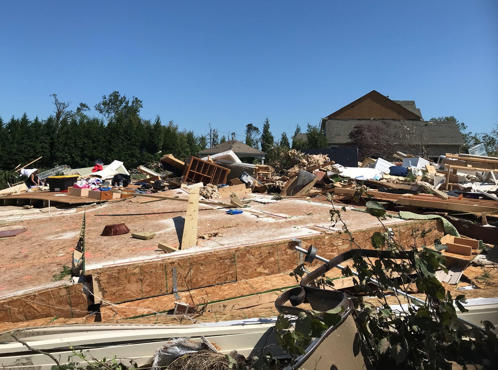
- Harrisonville to Mullica Hill to Deptford (Gloucester County), EF-3: Touched down at 6:10 PM near Harrisonville and stayed on the ground for 20 minutes along a 12.6-mile path, up to 400 yards wide, with peak winds near 150 mph. In the Willow Oaks neighborhood and along Salvatore Drive in Harrison Township, homes lost roofs and walls, and one house was completely destroyed. It also flattened barns and two grain silos at a dairy farm. Two people were hurt and no one was killed. It was New Jersey's first EF-3 (or F-3) since Montgomery Township in Somerset County on October 18, 1990, and only the fifth since records began in 1950.
- Burlington Township to Bristol, PA, EF-1: Touched down at 6:59 PM near the Edgewater Park line, brought down nearly 30 trees along Beverly Road, then crossed the Delaware River by the Burlington-Bristol Bridge and lifted near Bristol in Bucks County at 7:04 PM. Peak winds were about 90 mph.
- West Windsor (Mercer County), EF-0: A brief 75 mph tornado along Route 1 just east of Princeton from 7:32 to 7:35 PM.
Across the river, Bucks County had two EF-1 tornadoes (one near Doylestown, one in Upper Makefield Township). An EF-2 with 130 mph winds hit Fort Washington and Upper Dublin Township in Montgomery County and caused the only tornado death of the outbreak. More on how rare this is: tornadoes in New Jersey.
Rain that fell faster than anything could drain
The NJ State Climatologist's quality-checked totals topped out at 9.45 inches in Hillsborough (Somerset), with 9.20 inches in Flemington, 9.13 in Hopewell Township, 9.02 in North Arlington, 8.72 in Harrison and 8.44 in New Brunswick. The National Hurricane Center's report lists 10.06 inches at Manville.
- Newark Airport: 8.44 inches total. Its wettest 60 minutes brought 3.65 inches (ending at 9:10 PM), and its wettest six hours brought 7.98 inches. The State Climatologist estimated both as roughly 1-in-1,000-year rates.
- Hillsborough: 8.10 inches in six hours, the most of any Rutgers weather station.
- Central Park: 3.15 inches fell in the single hour ending at 9:51 PM, and the storm total was 7.19 inches.
- Staten Island: 9.64 inches, the highest total the hurricane center lists for New York.
The heaviest burst moved from west to east. Hunterdon County peaked around 6:45 PM, Newark around 9 PM, and Bergen County around 10 PM.
Flash Flood Emergencies, one after another
A Flash Flood Emergency is the most urgent kind of flash flood warning, used only when severe flooding is already happening and lives are at risk. That night the Weather Service issued them across our whole area:
- 7:05 PM: much of Bucks County, PA.
- 7:31 PM: much of Mercer County including Trenton, plus southeast Hunterdon.
- 8:02 PM: northeastern Somerset and northern Middlesex, with numerous water rescues underway.
- 8:41 PM: Bergen, Essex, Hudson, Passaic and Union counties, plus Staten Island.
- 9:28 PM: the New York City metro (the Bronx, Brooklyn, Manhattan, Queens) and southern Westchester, with rain rates of 3 to 5 inches an hour expected.
Several of the Mount Holly warnings carried the words "PARTICULARLY DANGEROUS SITUATION" and "SEEK HIGHER GROUND NOW!" The Upton office, which covers northeast New Jersey and New York City, had not issued a Flash Flood Emergency before that night in records going back to 2003. The 8:41 PM warning, which included Staten Island, was the first to cover any part of New York City.
The human toll
About 30 people died in New Jersey, the State Climatologist reported, most of them drowned in or near cars or in their homes. (The hurricane center counts 26 deaths in New Jersey as directly caused by the storm.) That made Ida the second deadliest natural event in New Jersey in at least a century, behind only Sandy. Much of the flooding came after dark, which likely made it deadlier.
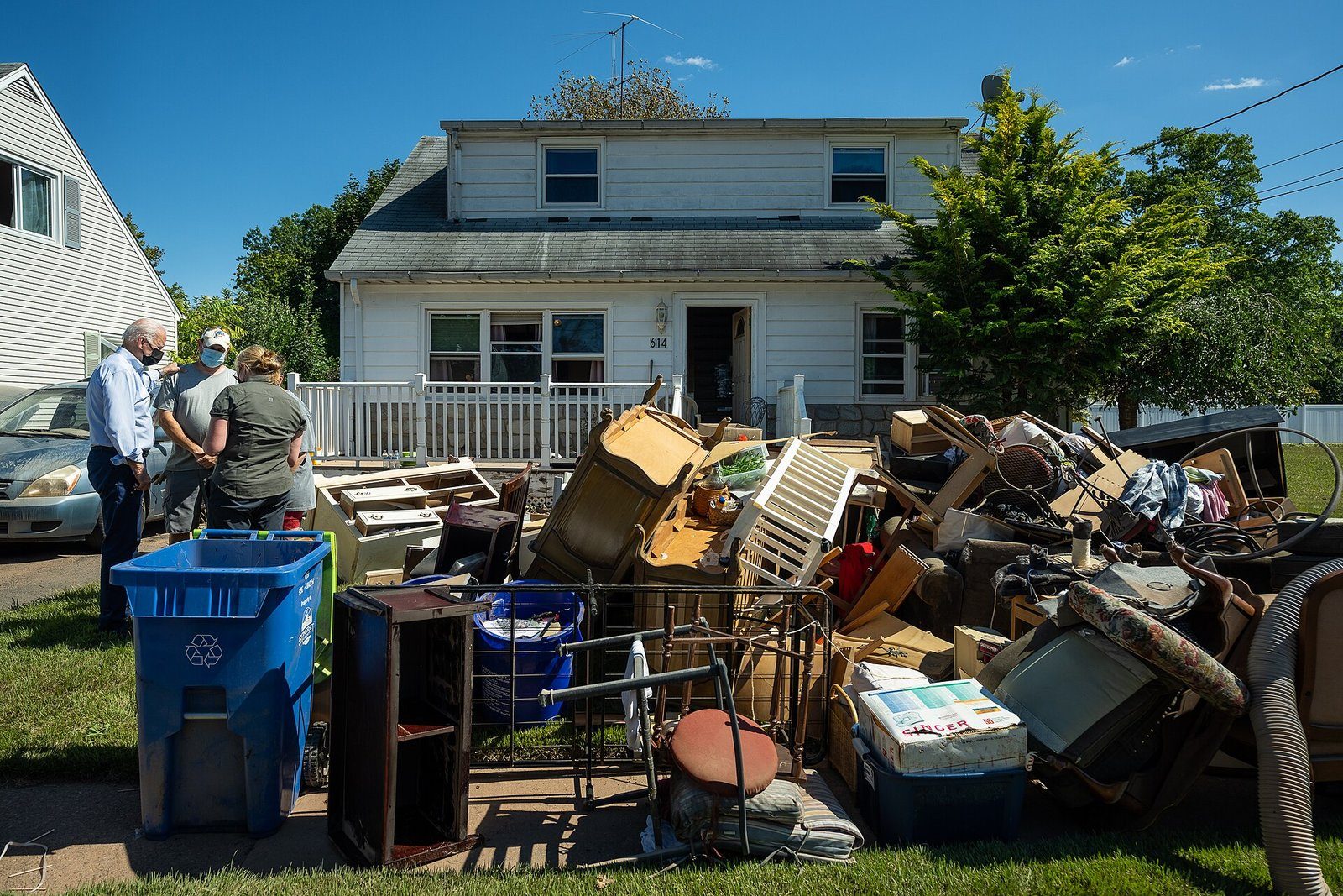
New York had 16 direct deaths, and 11 of those people drowned inside their homes or apartments. Weather Service storm reports that night described deadly flooding in basement apartments in Queens. Pennsylvania had 5 direct deaths. The hurricane center estimated flood damage at $8 to $10 billion in New Jersey alone.
The rivers rise the next day
After the flash floods came the river floods. The Raritan basin took the worst of it:
- Raritan River at Manville: reached about 27.7 feet on September 2, almost double its 14-foot flood stage. The State Climatologist called it a record crest. Floodwater from the Raritan and Millstone swamped parts of Manville, gas explosions damaged several homes and a business, and several hundred people were left temporarily homeless.
- Raritan River at Bound Brook: read 41.1 feet on the morning of September 2, far above its 28-foot flood stage. The gauge failed before the river crested, so the true peak is unknown.
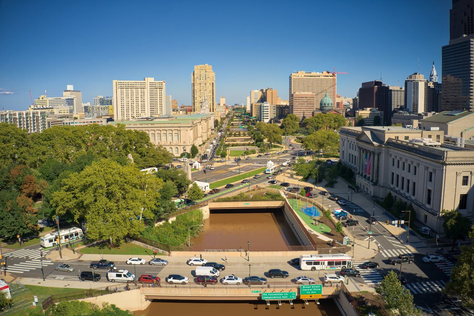
- Schuylkill River at Philadelphia: rose to about 16.4 feet on September 2, more than 5 feet above flood stage and close to the flood of record. It put several feet of water on parts of the Vine Street Expressway. Upstream, the Schuylkill at Norristown set a flood of record.
- Delaware River: even tidal stretches flooded from all the fresh water. The gauges at Newbold Island (near Florence and Bordentown) and Bridesburg in Philadelphia both set floods of record.
On the Raritan and Millstone, the crests were very close to those of Floyd in 1999 and Irene in 2011. Those three storms are now the three biggest floods in the basin in at least a century.
What it means today
Ida proved a storm does not need hurricane winds to be deadly here. The danger was water, falling faster than drains and streams could handle, mostly at night. Lessons we keep coming back to:
- Treat a Flash Flood Emergency as a "move now" alert. Get to higher ground, and do not wait to see the water.
- Never drive into a flooded road. Most of New Jersey's deaths happened in or near vehicles.
- Basements are the riskiest place in a flash flood. If you live or sleep below ground, have a plan to get upstairs quickly.
- Tropical remnants can spin up tornadoes, even in South Jersey, so keep alerts on for tornado warnings too.
Our flash flood safety guide covers what to do before, during and after.
- National Hurricane Center Tropical Cyclone Report: Hurricane Ida (AL092021)
- Ida Remnants Strike New Jersey (Office of the NJ State Climatologist, Rutgers)
- 1 September 2021: Remnants of Ida (NWS Mount Holly event review)
- NWS Upton and Mount Holly Flash Flood Warnings, Sept. 1-2, 2021 (archived text)
- NWS Tornado and Flash Flood Emergencies list (Iowa Environmental Mesonet)
- Central Park and Newark Airport hourly precipitation, Sept. 1-2, 2021 (ASOS data, Iowa Environmental Mesonet)
For dangerous weather, always follow official National Weather Service warnings and your local emergency officials.