
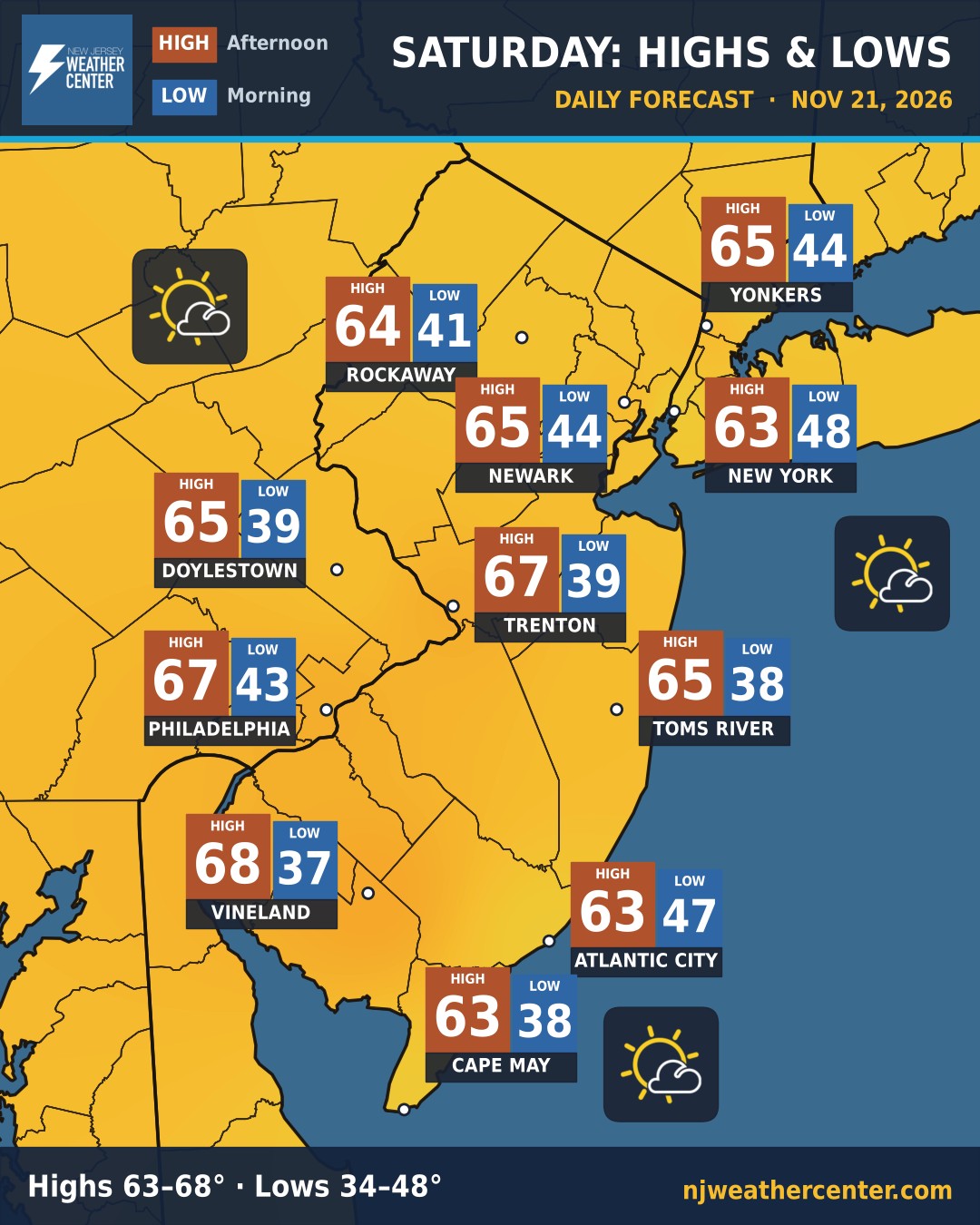
Saturday: a mix of sun and clouds, highs 63 to 68
Saturday brings a mix of sun and clouds. Highs run 63 to 68°, warmest in Vineland (68°) and coolest in 4 of our 15 towns (63°).
Lows this morning range from 34 to 48°, coolest in Newton (34°) and mildest in New York (48°).
No rain in the forecast for any town we track.
No watches, warnings or advisories are in effect for our area right now.
Every town's low, high and rain chance
Yesterday's answer
A new question every morning. Come back tomorrow!
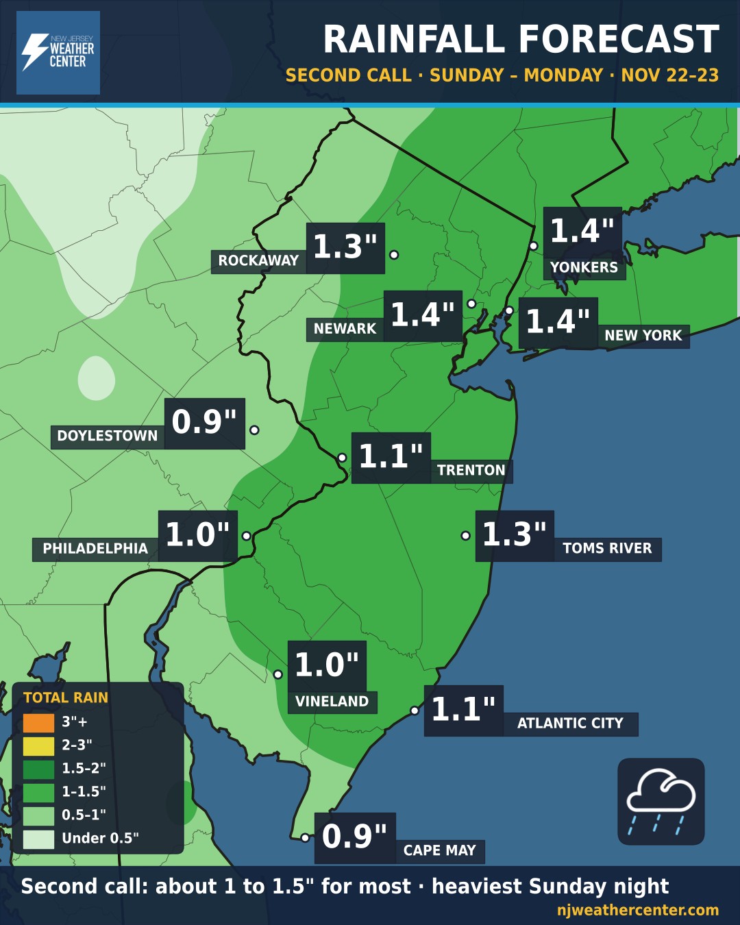
Second Call: Sunday's storm trends offshore
The threats: rain, heavy at times, Sunday afternoon into Monday morning, with about 1 to 1.5 inches for most of NJ, NYC and Philly, heaviest Sunday night. Gusts of 20 to 25 mph inland and 25 to 30 mph at the Shore. Watch for ponding and poor-drainage flooding Sunday night.
The storm shifted farther out to sea, so totals are down from Friday's First Call. The National Hurricane Center now gives it only a 10% chance of becoming tropical.
Heading to the game? We post a game-day forecast for every Yankees, Giants, Jets, Red Bulls, NYCFC and Westchester SC home game: the temperature at the start and the end, the sky, rain chance and wind at the stadium. Teams show here while they still have home games left this season.
Game-day forecasts
No home games on today's schedule. Game-day forecasts show up here on game day. See what they look like.
Past game-day forecasts: Sports Archive. NJ Weather Center isn't affiliated with any team or league. Team names are used only to identify the games.
Active alerts
Loading the latest alerts from the National Weather Service…
Colors follow the National Weather Service. Tap an alert to read the headline. For full details and safety information, always check weather.gov.
When weather slows things down, we post an airport delays map (from the FAA) and a road conditions map for the major highways, from green (no problems) to red (extremely dangerous).
No weather travel problems right now. See what the maps look like: Airport Delays · Road Conditions. Live airport delays, updated automatically: our Travel page · FAA airport status · 511NJ
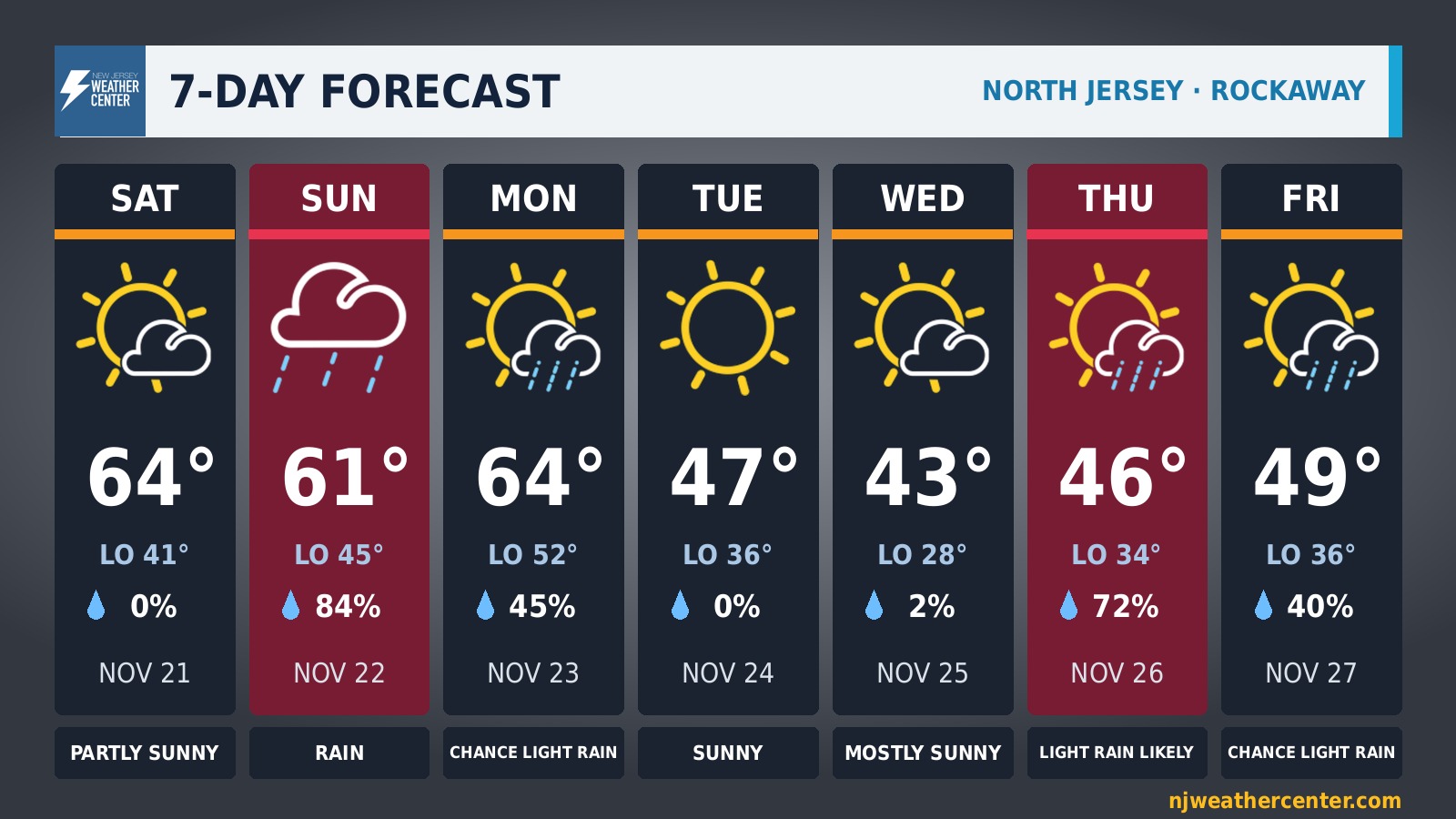
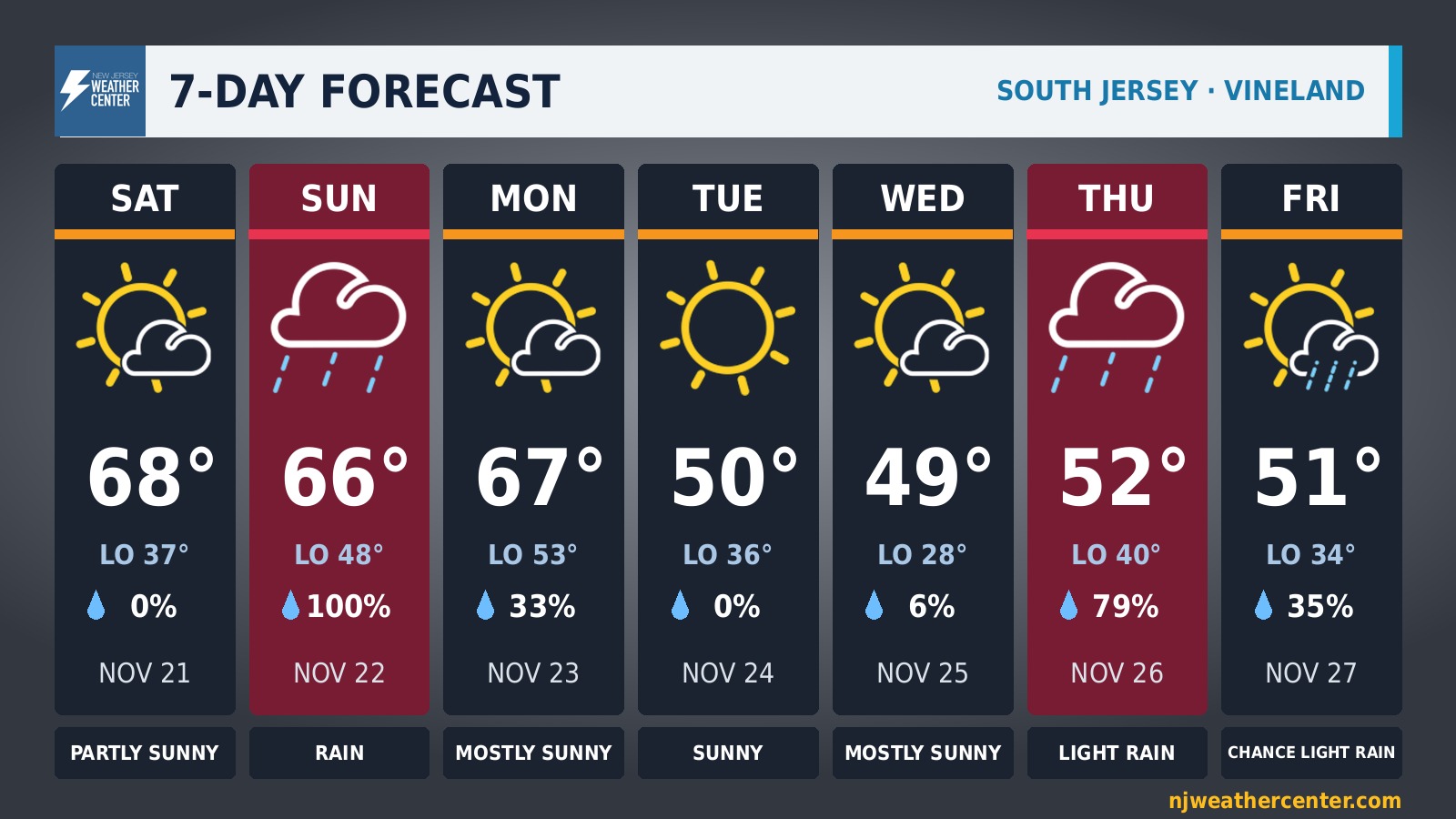
Rain chances Sunday and Thursday, warmest Saturday
Saturday is the warmest day of the week, reaching 64° in Rockaway and 68° in Vineland. Wednesday is the coolest afternoon, with highs of 43° in Rockaway and 49° in Vineland.
Rain is most likely Sunday: 84% in Rockaway and 100% in Vineland. Rain chances also reach 50% or more on Thursday.
The coldest morning is Wednesday, with lows of 28° in Rockaway and 28° in Vineland.
Day-by-day table, North vs. South Jersey ›
How does today compare?
See your town's average highs and lows, rain, snow, record temperatures and freeze dates.
Atlantic City · Boonton · Caldwell · Cape May · Doylestown · Estell Manor · Flemington · Harrison · Hightstown · JFK Airport · LaGuardia Airport · Long Branch · Millville · Moorestown · Mount Holly · Neshaminy Falls · New Brunswick · New York City · Newark · Northeast Philadelphia · Philadelphia · Phillipsburg · Sellersville · Short Hills · Shrub Oak · Somerset Airport · Sussex · Teterboro · Trenton · West Milford · White Plains
All towns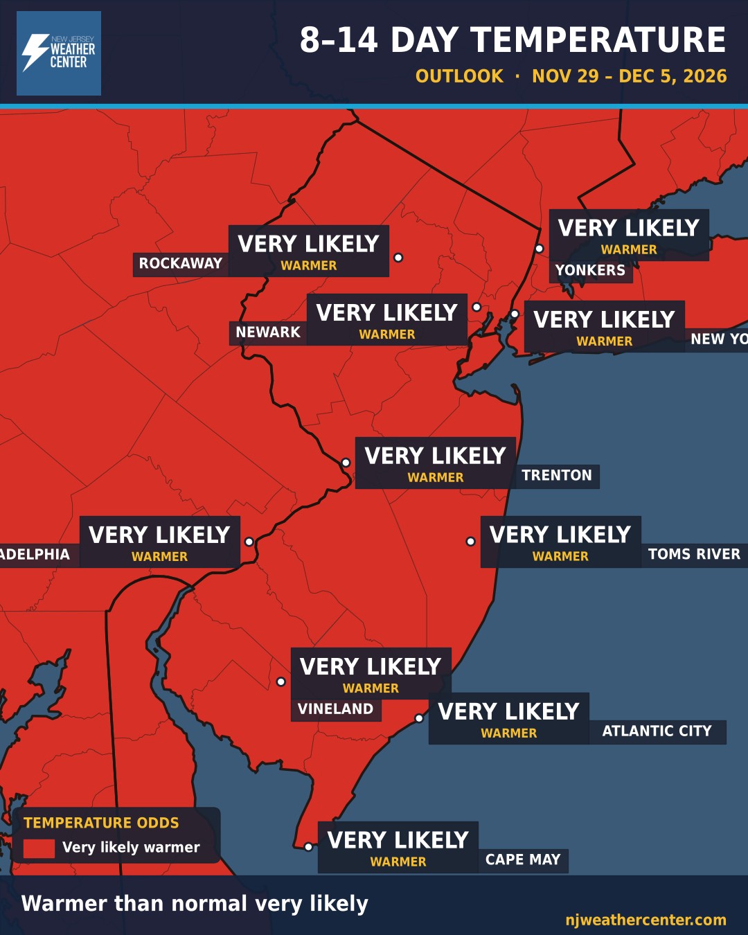
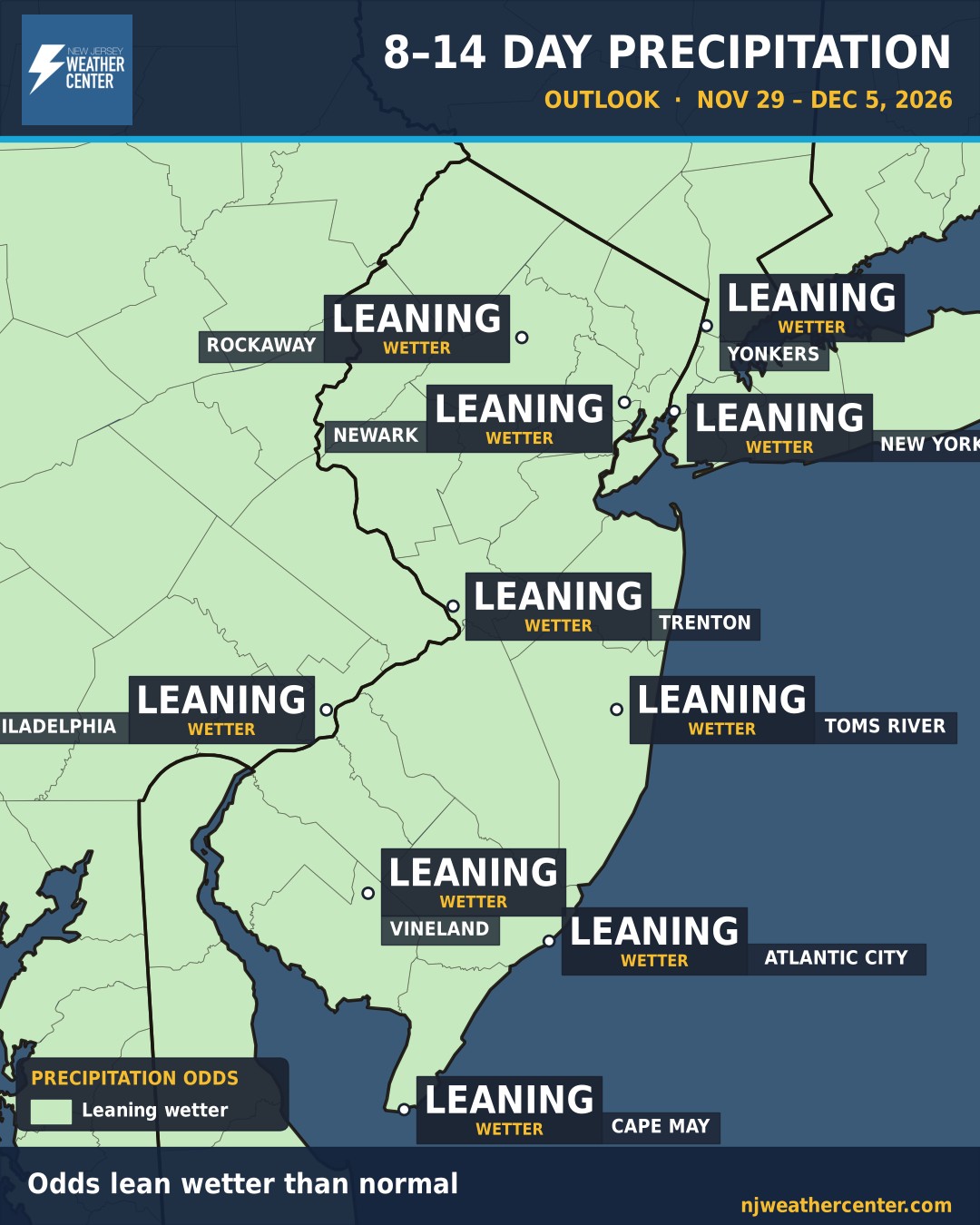
Early December looks warmer than normal, with a wetter lean
This is the big-picture look at Nov 29–Dec 5. It's not a day-by-day forecast. Think of it like the odds on a game: NOAA's Climate Prediction Center gives the chance that the week as a whole runs warmer, colder, wetter or drier than normal for this time of year.
Temperatures: Warmer than normal is very likely for all of us, from Rockaway and NYC down to Cape May.
Rain: The odds lean wetter than normal for all of us, from Rockaway and NYC down to Cape May. These are odds for the week as a whole, not a promise for any one day.
Get the forecast in your inbox
Sign up for email alerts from NJ Weather Center. Pick what you want: the morning forecast, a heads-up when a storm is coming, or game-day forecasts. Unsubscribe anytime.
What we post
Here's what you'll see from NJ Weather Center. Daily maps go up every morning. Storm, tropical and severe maps go up when the weather calls for them. Click any one to see an example and how to read it. Storm examples are made-up storms, not real forecasts.
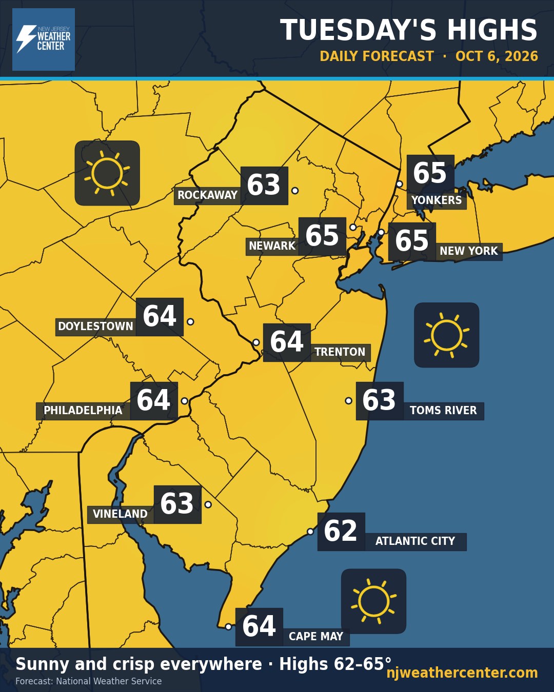
Afternoon highs and sky conditions for 11 cities across NJ, NYC, Westchester, Bucks and Philly.
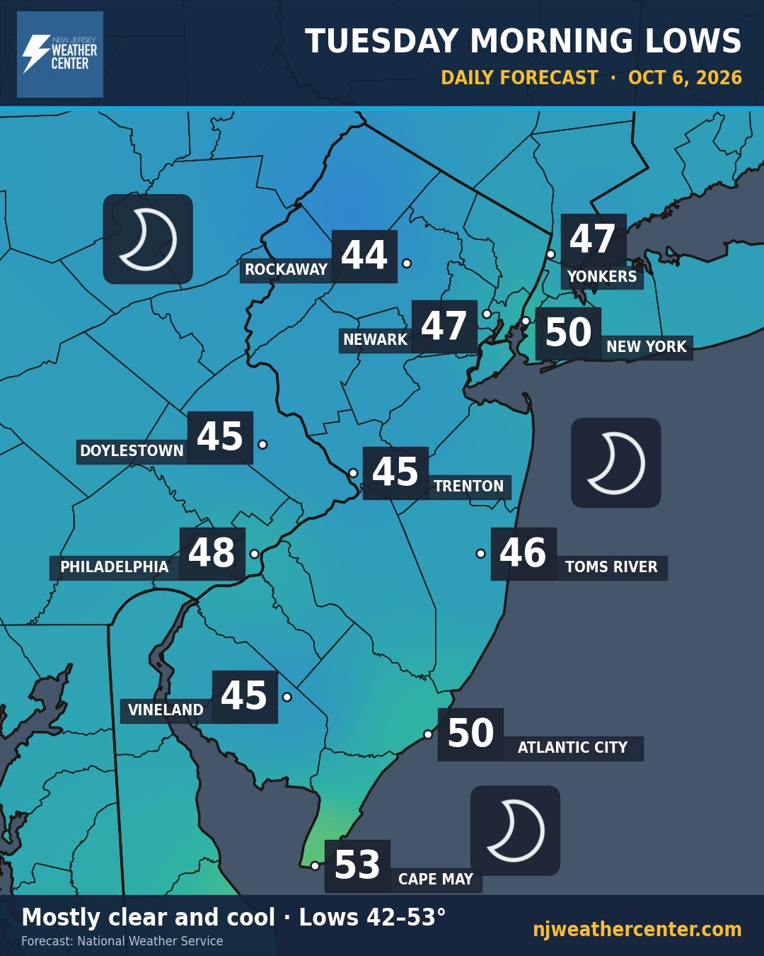
How cold you wake up, so you know if it's a jacket morning.
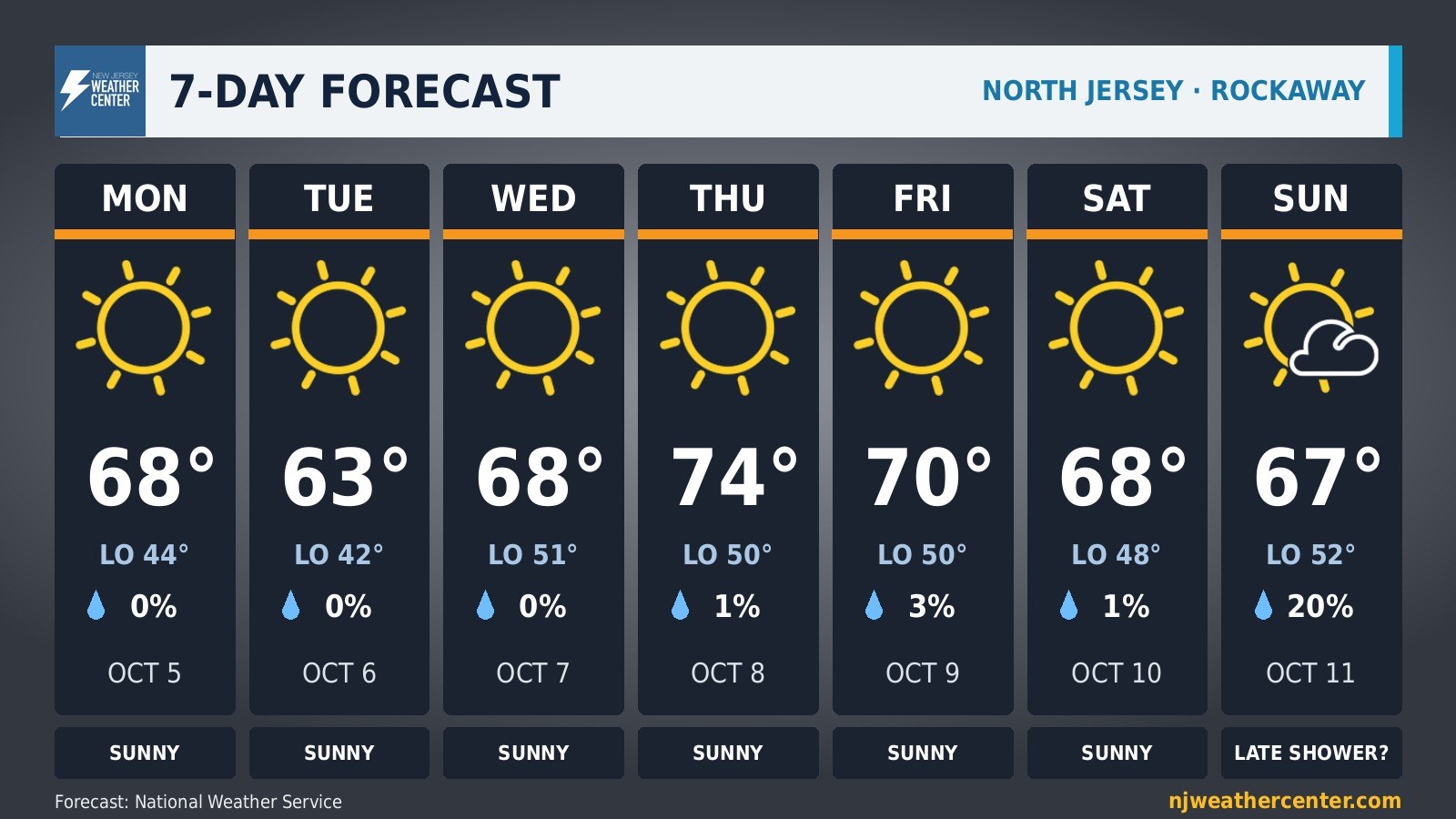
The week at a glance: highs, lows, rain chances and the sky, with a short write-up.
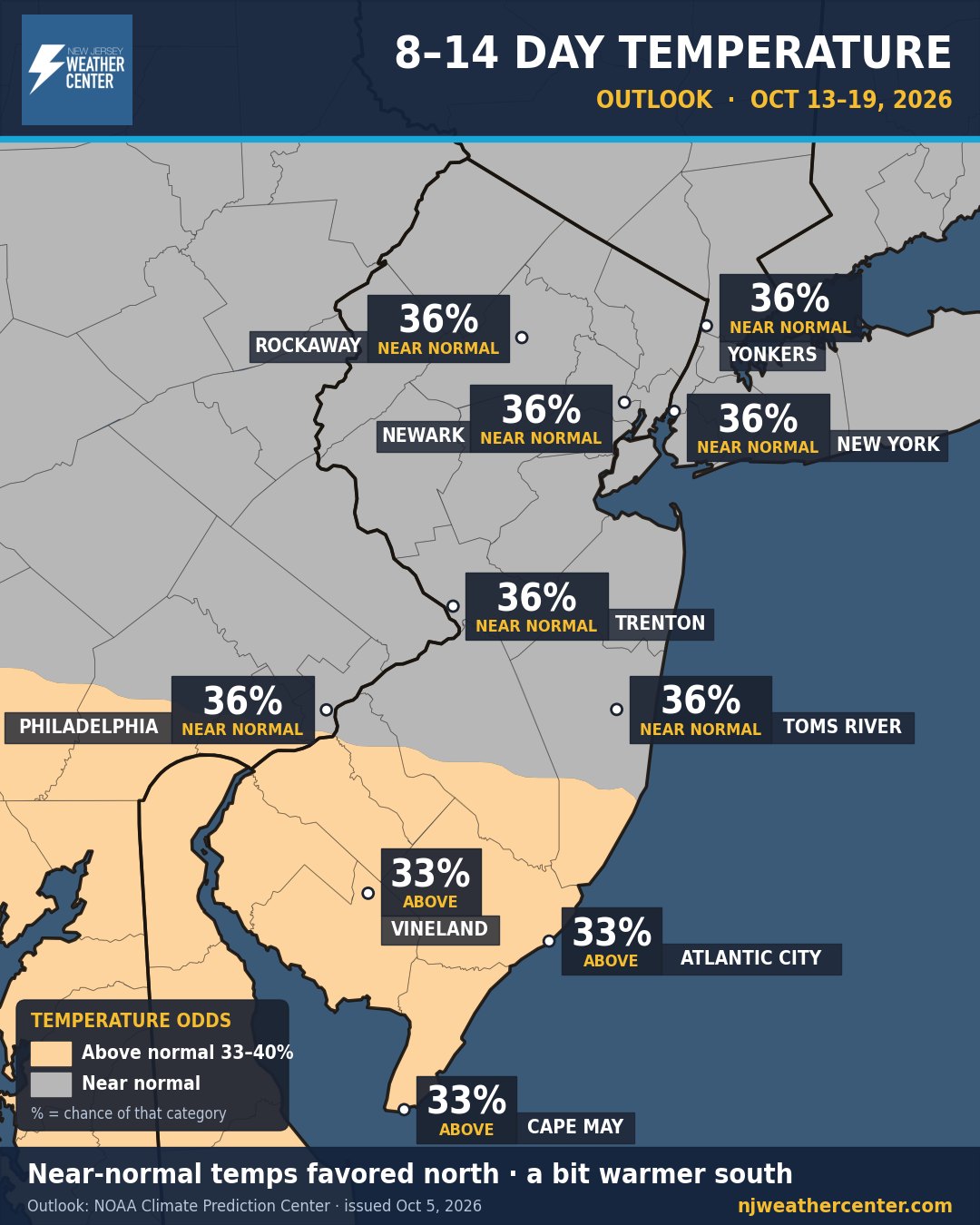
The odds that week two runs warmer, colder, wetter or drier than normal, from NOAA's Climate Prediction Center.
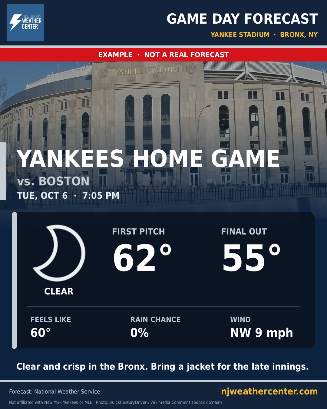
Yankees, Giants, Jets, Red Bulls, NYCFC and Westchester SC home games: start and end temps, rain and wind at the stadium.
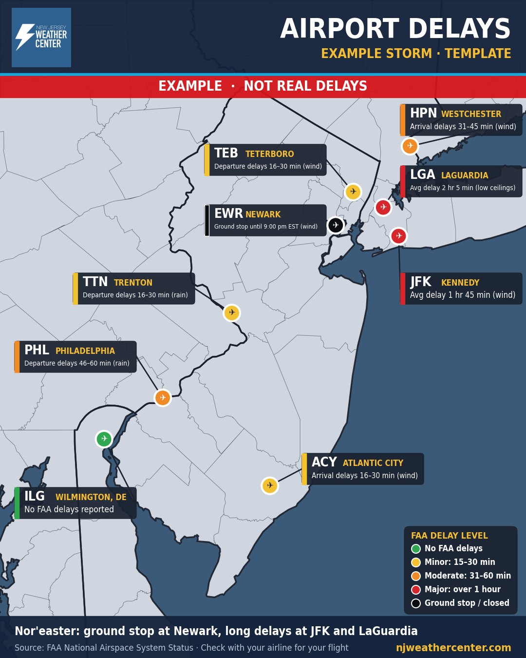
Delays, ground stops and closures at Newark, JFK, LaGuardia, Philly and the other airports around us, from the FAA.
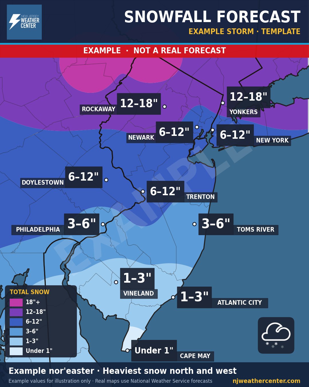
Who gets how much, where the heaviest bands set up, and where it turns to rain.
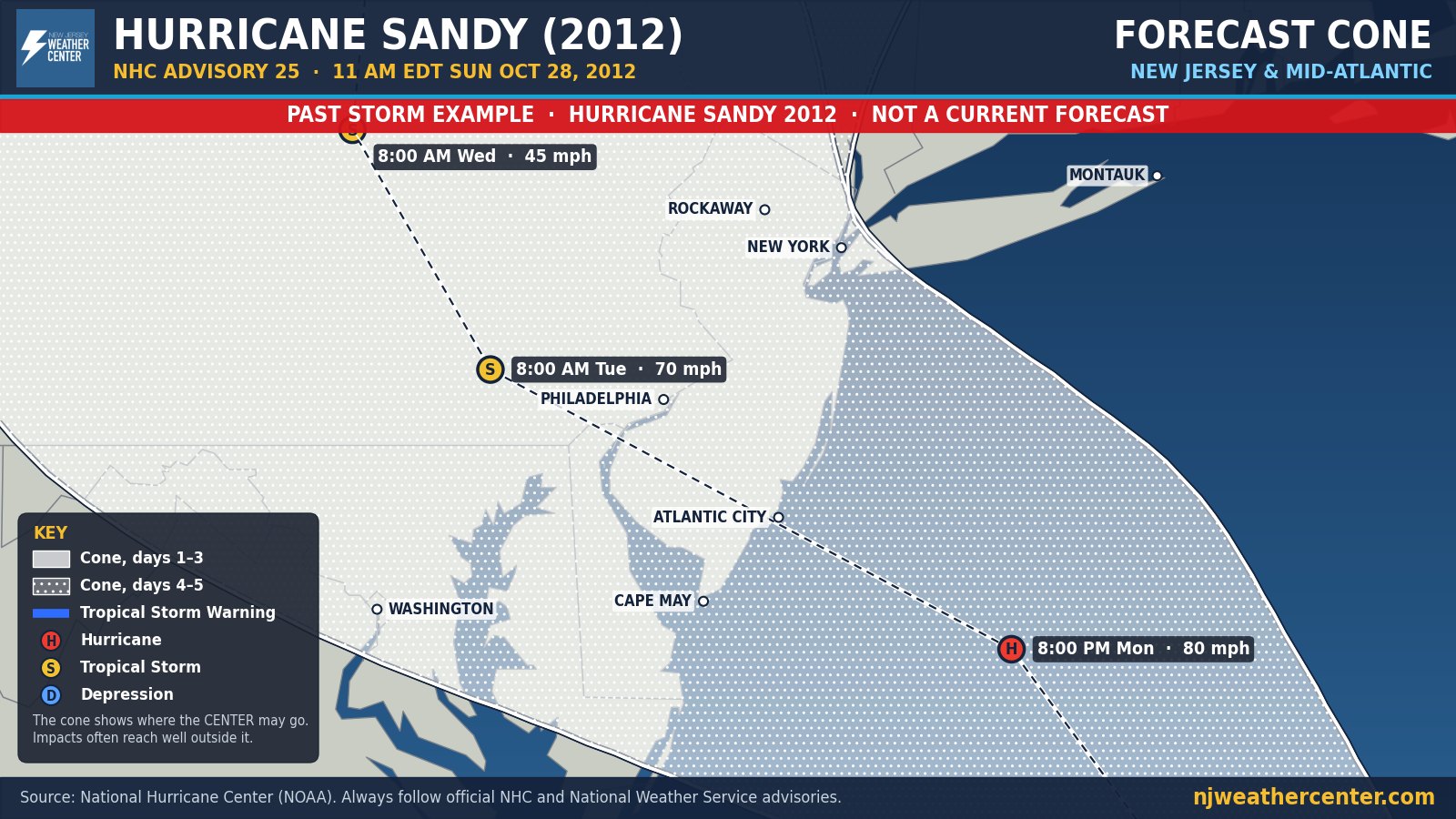
The official National Hurricane Center cone, track and strength, in views from the whole Atlantic down to New Jersey.
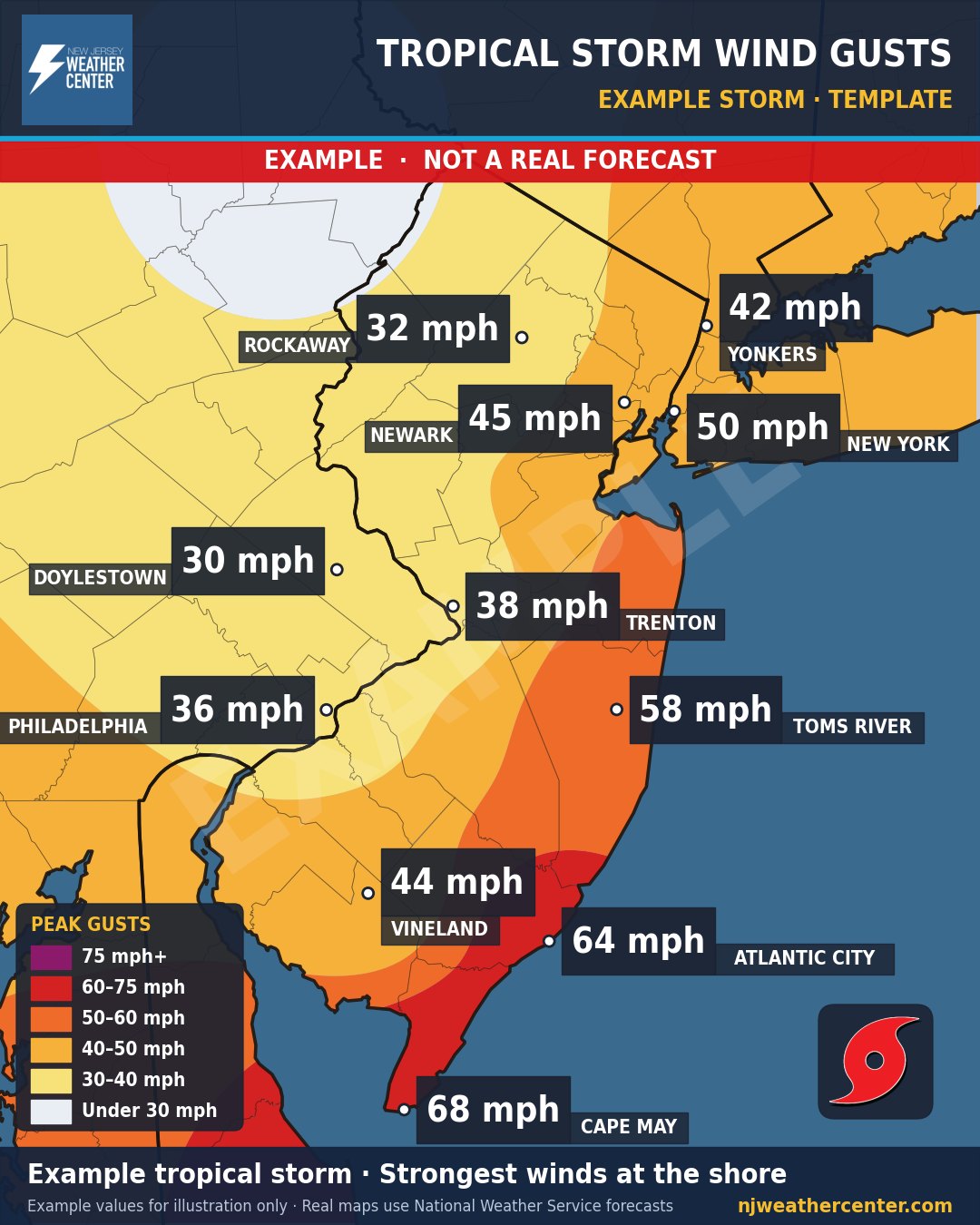
Peak wind gusts town by town when a tropical system gets close.
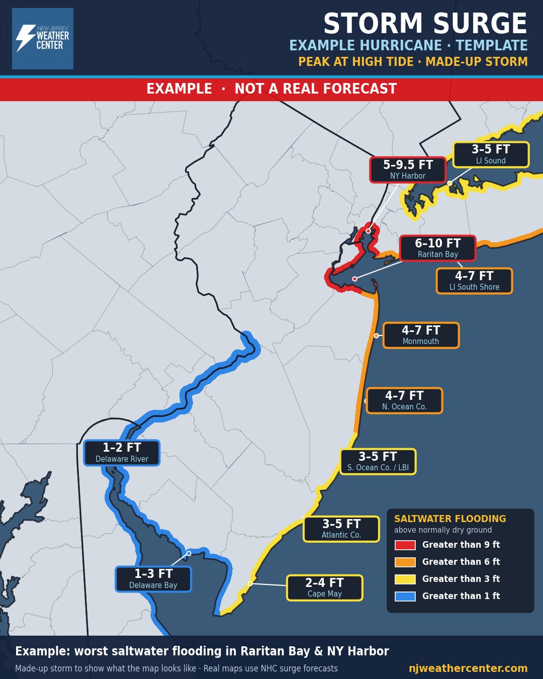
How deep saltwater flooding could get along each stretch of the coast, back bays and rivers.
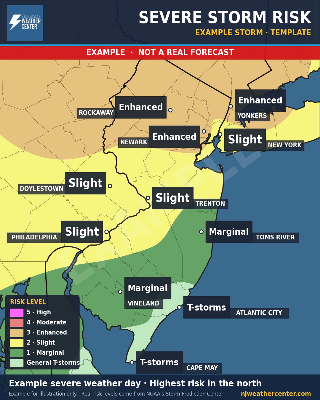
Where strong storms are most likely and what to expect: wind, hail, flooding.
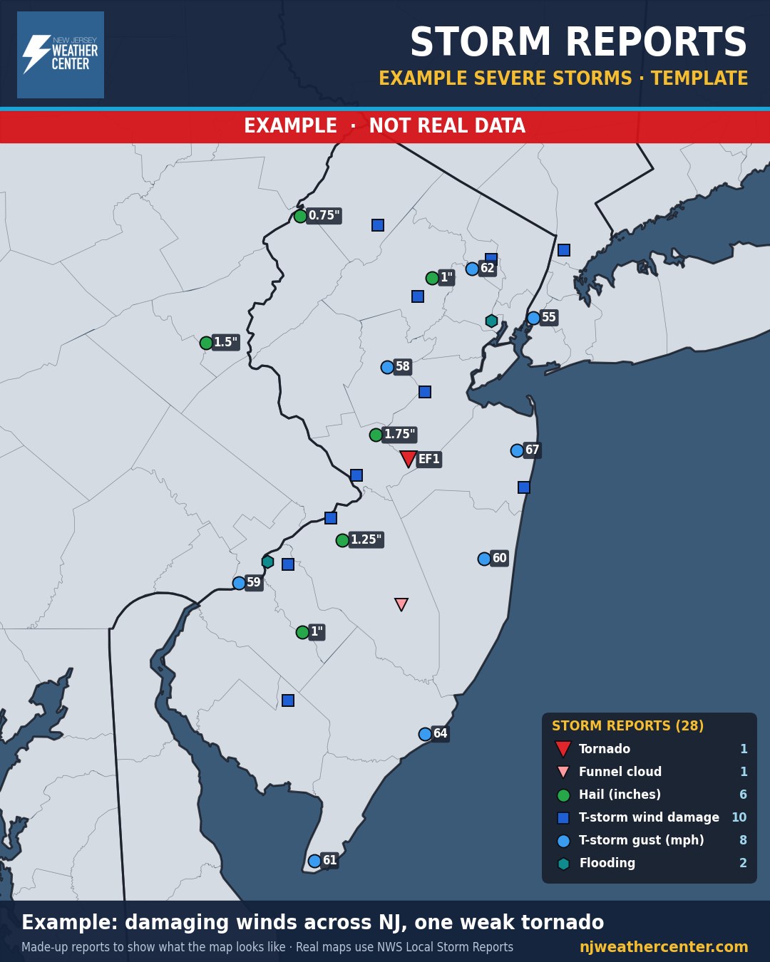
What actually happened: tornado, hail, wind damage and flooding reports from the National Weather Service.
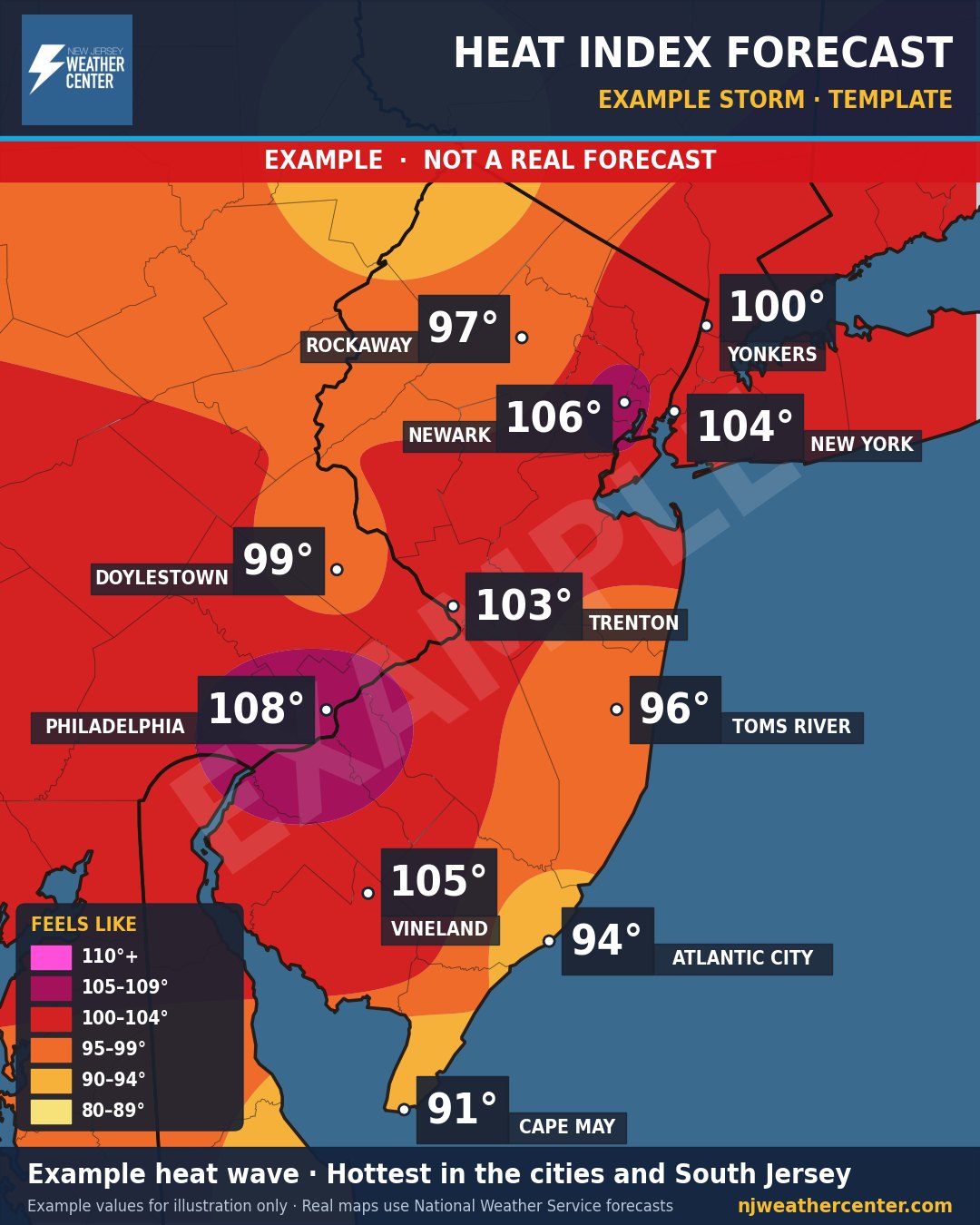
What it will actually feel like outside when it gets extreme.
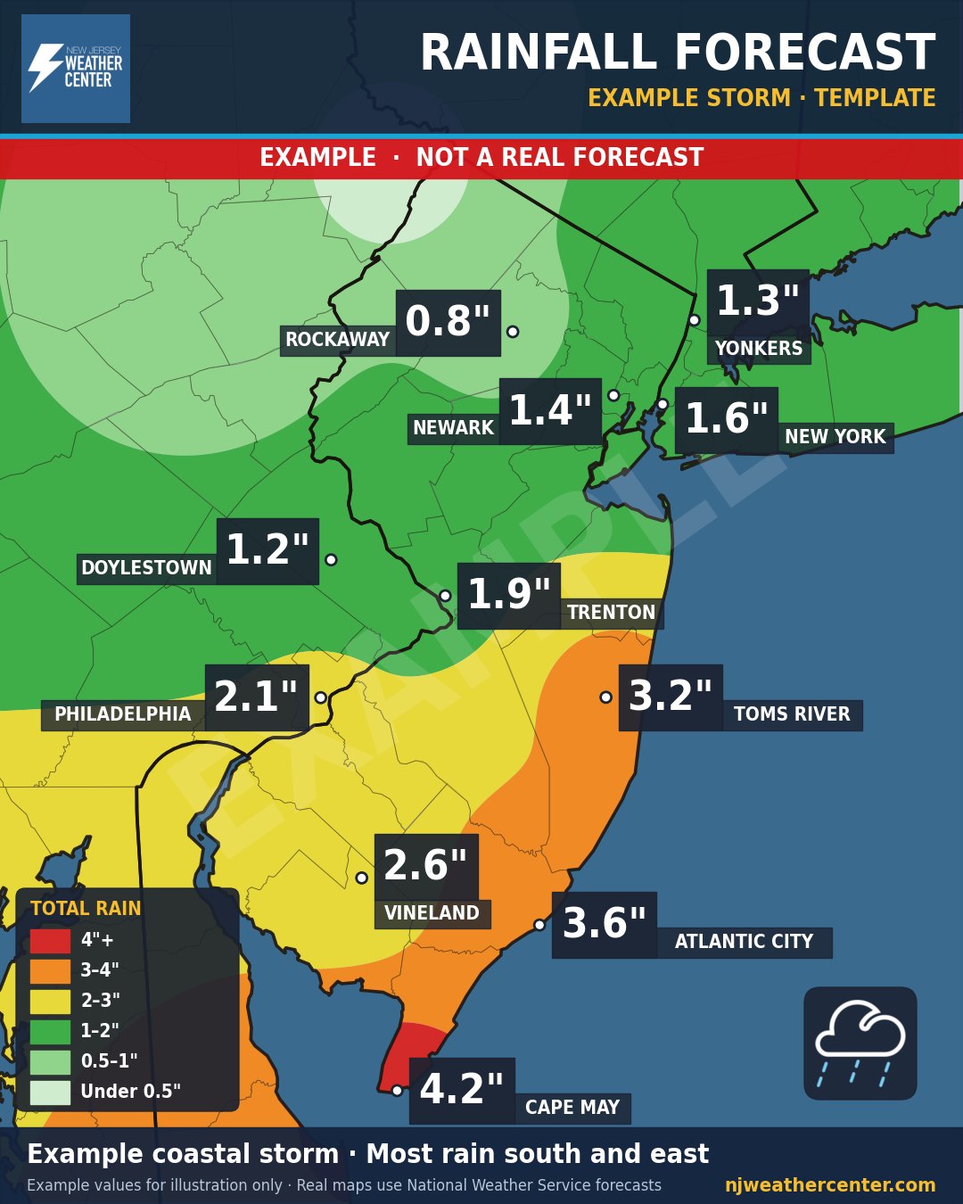
How much rain to expect and where flooding is most likely.
Storm Center
When a big storm is coming, it gets its own page: the snow or rain map, timing, wind, and a Storm Impact Index for your commute. The page is updated as the storm gets closer. Nothing active right now.
- Snow or rain map
- Timing
- Wind
- Commute impact